|
search place name
|
||
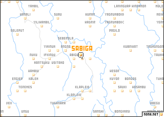
Sabiga (Sandaun, Papua New Guinea)Sabiga is a town in the Sandaun region of Papua New Guinea. An overview map of the region around Sabiga is displayed below.
regional and 3d topo map of Sabiga, Papua New Guinea ::
Sabiga airports ::
The nearest airport is WWK - Wewak Intl, located 123.0 km east of Sabiga.
Nearby towns ::
Mambu (0.0km north) //
Yiriwand (1.8km east) //
Sulunku (1.8km east) //
Abigu (1.8km west) //
Hambangri (2.6km south west) //
Awes (4.1km north west) //
Angna (4.1km north west) //
Poklo (5.2km north west) //
Seberola (5.2km north west) //
Aterum (5.8km west) //
Usitamo (5.8km west) //
Kembien (5.8km west) //
Klaplei 1 (7.4km south) //
Hambasamba (7.4km west) //
Ifkindu (7.4km west) //
Wagrir (7.6km north) //
Kafle (7.6km south) //
Yiminum (7.6km west) //
Wesor (8.3km south east) //
Kuyor (9.3km south east) //
Pagilo (9.3km north east) //
Yagrumbok 2 (10.5km north east) //
Fumatambu (10.5km south east) //
[all distances 'as the bird flies' and approximate] 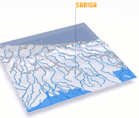 Places with similar names to Sabiga, Papua New Guinea ::
Disclaimer :: Information on this page comes without warranty of any kind |
||
|
Where is Sabiga? Elevation and coordinates ::
Latitude (lat): 3°41'0"S Longitude (lon): 142°34'0"E
Elevation (approx.): 213m (map arrows pan, magnifying glasses zoom) |
||
|
Visiting Sabiga? Hotel/Accommodation ::
Book a hotel in Sabiga Travel Guide ::
rental cars ::
car rental offers GPS waypoint ::
download a GPX waypoint (PoI) of Sabiga for your GPS receiver
|
||