|
search place name
|
||
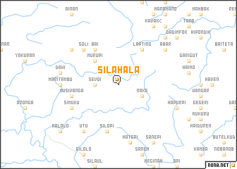
Silahala (Papua New Guinea)Silahala is a town in Papua New Guinea. An overview map of the region around Silahala is displayed below.
regional and 3d topo map of Silahala, Papua New Guinea ::
Silahala airports ::
The nearest airport is MAG - Madang, located 26.1 km south east of Silahala.
Other airports nearby include GKA - Goroka (114.6 km south), HGU - Mount Hagen (167.2 km south west), LAE - Nadzab (207.8 km south east), WWK - Wewak Intl (269.9 km north west), Nearby towns ::
Sevoi (3.7km west) //
Saruga (3.7km west) //
Manep (4.1km south east) //
Bagupi (4.1km south east) //
Nake (4.1km south east) //
Itapi (4.1km south east) //
Murupi (5.2km north west) //
Bai (6.7km north west) //
Lapting (6.7km north east) //
Autabak (7.6km south) //
Silopi (7.6km south) //
Musivanga (7.6km west) //
Soli (7.8km north west) //
Simuku (8.3km south west) //
Utu (9.3km south west) //
Guteb (9.3km south west) //
Samosa (9.2km north west) //
Abar (9.2km north east) //
Budip (10.5km north east) //
[all distances 'as the bird flies' and approximate] 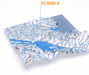 Places with similar names to Silahala, Papua New Guinea ::
// Solley Hill (US)
// Sealy Hall (BB)
// Sealy Hill (BB)
// Salahual (PE)
// Salhala (NG)
// Solihull (GB)
Disclaimer :: Information on this page comes without warranty of any kind |
||
|
Where is Silahala? Elevation and coordinates ::
Latitude (lat): 5°4'0"S Longitude (lon): 145°36'0"E
Elevation (approx.): 596m (map arrows pan, magnifying glasses zoom) |
||
|
Visiting Silahala? Hotel/Accommodation ::
Book a hotel in Silahala Travel Guide ::
rental cars ::
car rental offers GPS waypoint ::
download a GPX waypoint (PoI) of Silahala for your GPS receiver
|
||