|
search place name
|
||
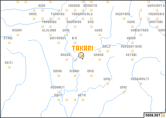
Takari (Papua New Guinea)Takari is a town in Papua New Guinea. An overview map of the region around Takari is displayed below.
regional and 3d topo map of Takari, Papua New Guinea ::
Takari airports ::
The nearest airport is GKA - Goroka, located 64.9 km north of Takari.
Other airports nearby include LAE - Nadzab (143.4 km east), HGU - Mount Hagen (156.4 km north west), MAG - Madang (166.1 km north), Nearby towns ::
Rare-Amusa (1.8km west) //
Amuraisa-Toroto (2.6km north west) //
Amusa (3.7km west) //
Umasa (3.7km east) //
Misapi (4.1km south west) //
Eteve (4.1km south west) //
Orie (4.1km south east) //
Iva (4.1km north west) //
Imtamatasa (4.1km north east) //
Kalu (5.8km east) //
Somai (6.7km south west) //
Uvai (6.7km north west) //
Waiyanavi (6.7km north west) //
Kume (6.7km north east) //
Amuraisa (7.6km north) //
Arovaraisa (7.6km north) //
Emo (7.6km north) //
Urai (7.8km south east) //
A'u'uwaiyi (9.2km south west) //
A'ibu (9.2km north west) //
Eli'ilaba (9.2km north west) //
Taro-Aibu (10.4km north west) //
Fusa (10.4km north west) //
[all distances 'as the bird flies' and approximate]  Places with similar names to Takari, Papua New Guinea ::
Disclaimer :: Information on this page comes without warranty of any kind |
||
|
Where is Takari? Elevation and coordinates ::
Latitude (lat): 6°40'0"S Longitude (lon): 145°26'0"E
Elevation (approx.): 1610m (map arrows pan, magnifying glasses zoom) |
||
|
Visiting Takari? Hotel/Accommodation ::
Book a hotel in Takari Travel Guide ::
rental cars ::
car rental offers GPS waypoint ::
download a GPX waypoint (PoI) of Takari for your GPS receiver
|
||