|
search place name
|
||
Tetebedi (Papua New Guinea)Tetebedi is a town in Papua New Guinea. An overview map of the region around Tetebedi is displayed below.
regional and 3d topo map of Tetebedi, Papua New Guinea ::

Tetebedi airports ::
The nearest airport is POM - Port Moresby Jacksons Intl, located 97.9 km west of Tetebedi.
Nearby towns ::
Duau (1.9km south) //
Awoma (1.8km west) //
Ujilo (2.6km north west) //
Ejaro (2.6km north west) //
Muni (2.6km north west) //
Kovio (5.6km south) //
Rumara (5.9km north) //
Emo (5.9km north) //
Managube (8.3km north west) //
Pawa Ha (8.3km north west) //
Rumara (8.3km north west) //
[all distances 'as the bird flies' and approximate] 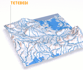 Places with similar names to Tetebedi, Papua New Guinea ::
// Tudbāti (BD)
// Titibuti (TP)
// Teud Biti (SN)
// Teudeu Biti (SN)
// Tūt-e Bīdū (IR)
// Doiatābād (PK)
// Titabat (PK)
// Tatobity (CZ)
Disclaimer :: Information on this page comes without warranty of any kind |
||
|
Where is Tetebedi? Elevation and coordinates ::
Latitude (lat): 9°10'0"S Longitude (lon): 148°4'0"E
Elevation (approx.): 1022m (map arrows pan, magnifying glasses zoom) |
||
|
Visiting Tetebedi? Hotel/Accommodation ::
Book a hotel in Tetebedi Travel Guide ::
rental cars ::
car rental offers GPS waypoint ::
download a GPX waypoint (PoI) of Tetebedi for your GPS receiver
|
||