|
search place name
|
||
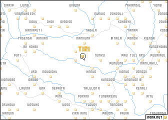
Tiri (Papua New Guinea)Tiri is a town in Papua New Guinea. An overview map of the region around Tiri is displayed below.
regional and 3d topo map of Tiri, Papua New Guinea ::
Tiri airports ::
The nearest airport is HGU - Mount Hagen, located 73.2 km north east of Tiri.
Other airports nearby include GKA - Goroka (174.2 km east), MAG - Madang (248.0 km north east), Nearby towns ::
Irawara (1.8km west) //
Pawari (2.6km north west) //
Pialeri (2.6km south east) //
Mankera (3.7km north) //
Munku (3.7km east) //
Mendo (4.1km south east) //
Magila (5.9km north) //
Kireni (5.9km north) //
Mambi (7.4km east) //
Taleloma (7.6km south) //
Pundura (7.6km east) //
Mungoro (7.8km south east) //
Pawaiamu (8.2km south west) //
Aisaisa (8.3km north west) //
Iamala (8.2km north east) //
Oman (9.2km north west) //
Mepaita (9.2km south west) //
Omai (10.5km north west) //
[all distances 'as the bird flies' and approximate] 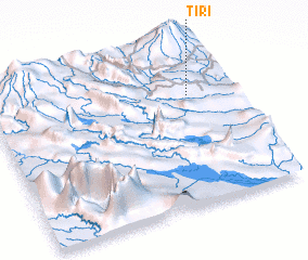 Places with similar names to Tiri, Papua New Guinea ::
Disclaimer :: Information on this page comes without warranty of any kind |
||
|
Where is Tiri? Elevation and coordinates ::
Latitude (lat): 6°18'0"S Longitude (lon): 143°50'0"E
Elevation (approx.): 1855m (map arrows pan, magnifying glasses zoom) |
||
|
Visiting Tiri? Hotel/Accommodation ::
Book a hotel in Tiri Travel Guide ::
rental cars ::
car rental offers GPS waypoint ::
download a GPX waypoint (PoI) of Tiri for your GPS receiver
|
||