|
search place name
|
||
Urou (Papua New Guinea)Urou is a town in Papua New Guinea. An overview map of the region around Urou is displayed below.
regional and 3d topo map of Urou, Papua New Guinea ::
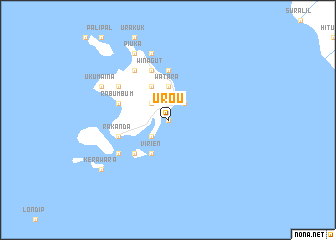
Nearby towns ::
Nouro (0.0km north) //
Kumlakor (2.6km north west) //
Kabiatarai (2.6km south west) //
Mualim (2.6km south west) //
Nambaul (2.6km north east) //
Nabual (2.6km north east) //
Laboa (3.7km north) //
Watara (3.7km north) //
Inlimut (3.7km north) //
Kabakabiui (4.1km north west) //
Virien (4.1km south west) //
Kababiai (4.1km north west) //
Mioko (5.2km south west) //
Utuan Number 2 (5.2km south west) //
Palpal (5.2km south west) //
Piratop (5.6km north) //
Waira (5.6km north) //
Walwalian (5.6km north) //
Butlivuan (5.9km north) //
Winagut (5.9km north) //
Kumaina (5.8km west) //
Rabumbum (5.8km west) //
Rakanda (5.8km west) //
Urakukur (6.7km north west) //
Kabilomu (6.7km north west) //
Utuan Number 1 (6.7km south west) //
Kabapuko (6.7km north west) //
Moloi (7.6km north) //
Maren (7.6km north) //
[all distances 'as the bird flies' and approximate] 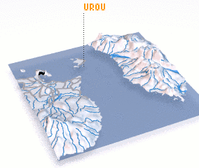 Places with similar names to Urou, Papua New Guinea ::
Disclaimer :: Information on this page comes without warranty of any kind |
||
|
Where is Urou? Elevation and coordinates ::
Latitude (lat): 4°12'0"S Longitude (lon): 152°29'0"E
Elevation (approx.): -32768m (map arrows pan, magnifying glasses zoom) |
||
|
Visiting Urou? Hotel/Accommodation ::
Book a hotel in Urou Travel Guide ::
rental cars ::
car rental offers GPS waypoint ::
download a GPX waypoint (PoI) of Urou for your GPS receiver
|
||