|
search place name
|
||
Vunalaiting (Papua New Guinea)Vunalaiting is a town in Papua New Guinea. An overview map of the region around Vunalaiting is displayed below.
regional and 3d topo map of Vunalaiting, Papua New Guinea ::
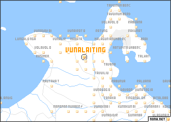
Nearby towns ::
Vunavavar (0.0km north) //
Vunakalkalulu (1.9km north) //
Ramale (1.9km south) //
Ramalmal (1.9km north) //
Tatoko (1.9km north) //
Vunatokukup (1.8km west) //
Raburbur (1.8km east) //
Vunapaka (1.8km west) //
Totovel (1.8km west) //
Vunalaka (2.6km south east) //
Taranga (2.6km north east) //
Reimber (2.6km south east) //
Kikitambu (2.6km south west) //
Raluan Number 1 (3.7km east) //
Raluan Number 2 (3.7km east) //
Toboina (4.1km north west) //
Rakanda (4.1km north west) //
Nabata (4.1km north west) //
Rakunai (4.1km south east) //
Rakandakanda (4.1km south east) //
Kurakakaul (4.1km north east) //
Kuraip (4.1km north east) //
Navuneram (5.2km south east) //
Iawakaka (5.2km north east) //
Tavuiliu (5.2km south east) //
Latlat (5.2km south east) //
Kabakada (5.6km north) //
Raluana (5.8km west) //
Vunairoto (5.9km north) //
[all distances 'as the bird flies' and approximate] 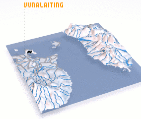 Places with similar names to Vunalaiting, Papua New Guinea ::
// Fanluodong (CN)
Disclaimer :: Information on this page comes without warranty of any kind |
||
|
Where is Vunalaiting? Elevation and coordinates ::
Latitude (lat): 4°15'0"S Longitude (lon): 152°6'0"E
Elevation (approx.): 209m (map arrows pan, magnifying glasses zoom) |
||
|
Visiting Vunalaiting? Hotel/Accommodation ::
Book a hotel in Vunalaiting Travel Guide ::
rental cars ::
car rental offers GPS waypoint ::
download a GPX waypoint (PoI) of Vunalaiting for your GPS receiver
|
||