|
search place name
|
||
El Castillo (Matagalpa, Nicaragua)El Castillo is a town in the Matagalpa region of Nicaragua. An overview map of the region around El Castillo is displayed below.
regional and 3d topo map of El Castillo, Nicaragua ::

El Castillo airports ::
The nearest airport is MGA - Managua Intl, located 74.6 km south west of El Castillo.
Other airports nearby include TGU - Tegucigalpa Toncontin Intl (216.3 km north west), Nearby towns ::
El Castillo (2.6km north west) //
Esquipulas (3.7km south) //
El Terrero (5.2km south west) //
Piedra Larga (5.4km west) //
Bella Vista (5.8km south) //
Pineda (6.6km north east) //
Los Portillos (6.6km north west) //
Obregones (7.4km north) //
Cumaica (7.5km east) //
Los Guidos (8.2km north west) //
El Rodeo (9.1km north east) //
San Dionisio (9.1km north west) //
El Río (10.4km south west) //
[all distances 'as the bird flies' and approximate] 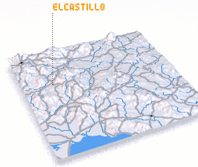 Places with similar names to El Castillo, Nicaragua ::
// El Castillo (PA)
// El Castillo (PA)
// El Castillo (PA)
// El Castillo (PA)
// El Castillo (PA)
// El Castillo (PA)
// El Castillo (PA)
// El Castillo (CU)
// El Castillo (ES)
// El Castillo (ES)
Disclaimer :: Information on this page comes without warranty of any kind |
||
|
Where is El Castillo? Elevation and coordinates ::
Latitude (lat): 12°42'0"N Longitude (lon): 85°47'0"W
Elevation (approx.): 712m (map arrows pan, magnifying glasses zoom) |
||
|
Visiting El Castillo? Hotel/Accommodation ::
Book a hotel in El Castillo Travel Guide ::
Buy a travel guide for Nicaragua rental cars ::
car rental offers GPS waypoint ::
download a GPX waypoint (PoI) of El Castillo for your GPS receiver
|
||