|
search place name
|
||
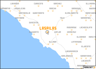
Las Pilas (Rivas, Nicaragua)Las Pilas is a town in the Rivas region of Nicaragua. An overview map of the region around Las Pilas is displayed below.
regional and 3d topo map of Las Pilas, Nicaragua ::
Las Pilas airports ::
The nearest airport is MGA - Managua Intl, located 86.3 km north of Las Pilas.
Other airports nearby include LIR - Liberia Daniel Oduber Quiros Intl (99.7 km south east), NOB - Nosara Beach Nosara (159.8 km south), SJO - San Jose Juan Santamaria Intl (247.6 km south east), XQP - Quepos La Managua (295.4 km south east), Nearby towns ::
El Coyol (2.6km north east) //
La Flor (3.6km east) //
Brito (3.7km south) //
El Limón (4.1km south east) //
El Tambor (5.2km north west) //
El Gigante (5.5km west) //
Güiscoyol (6.6km north west) //
San Jerónimo (7.3km east) //
Tola (7.8km north east) //
Guastomate (8.3km north west) //
[all distances 'as the bird flies' and approximate] 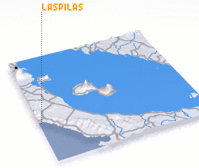 Places with similar names to Las Pilas, Nicaragua ::
// Las Pailas (CU)
// Las Palas (ES)
// Laspaúles (ES)
// Las Pilas (ES)
// Las Pullas (ES)
// Lacy Place (US)
// Los Palos (CL)
// Las Pailas (CO)
// Las Pailas (CO)
// Las Pailas (CO)
Disclaimer :: Information on this page comes without warranty of any kind |
||
|
Where is Las Pilas? Elevation and coordinates ::
Latitude (lat): 11°23'0"N Longitude (lon): 85°59'0"W
Elevation (approx.): 214m (map arrows pan, magnifying glasses zoom) |
||
|
Visiting Las Pilas? Hotel/Accommodation ::
Book a hotel in Las Pilas Travel Guide ::
Buy a travel guide for Nicaragua rental cars ::
car rental offers GPS waypoint ::
download a GPX waypoint (PoI) of Las Pilas for your GPS receiver
|
||