|
search place name
|
||
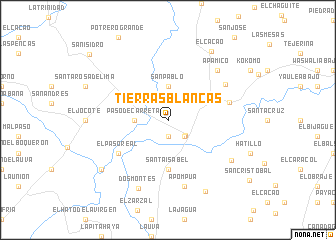
Tierras Blancas (Matagalpa, Nicaragua)Tierras Blancas is a town in the Matagalpa region of Nicaragua. An overview map of the region around Tierras Blancas is displayed below.
regional and 3d topo map of Tierras Blancas, Nicaragua ::
Tierras Blancas airports ::
The nearest airport is MGA - Managua Intl, located 80.4 km south of Tierras Blancas.
Other airports nearby include TGU - Tegucigalpa Toncontin Intl (177.9 km north west), Nearby towns ::
Río Nuevo (1.9km south) //
Sébaco (2.5km south east) //
Sébaco Viejo (2.6km south east) //
San Pablo (3.7km north) //
La Concepción (3.7km north) //
Paso de Carreta (3.6km west) //
Chagüitillo (4.3km north east) //
Santa Isabel (5.6km south) //
El Paso Real (6.6km south west) //
Los Cardones (7.0km east) //
Las Cuatro Esquinas (7.4km north east) //
Apompuá (7.6km south) //
Apamico (7.8km north east) //
Dos Montes (8.3km south west) //
Bilwaska (8.3km south east) //
Candelaria (9.0km south east) //
El Cacao (9.0km north east) //
Quebrada Honda (9.1km south west) //
San Isidro (11.2km north west) //
[all distances 'as the bird flies' and approximate]  Places with similar names to Tierras Blancas, Nicaragua ::
// Tierras Blancas (CL)
// Tierras Blancas (MX)
// Tierras Blancas (MX)
// Tierras Blancas (MX)
// Tierras Blancas (MX)
// Tierras Blancas (MX)
// Tierras Blancas (MX)
// Tierras Blancas (PE)
// Tierras Blancas (VE)
Disclaimer :: Information on this page comes without warranty of any kind |
||
|
Where is Tierras Blancas? Elevation and coordinates ::
Latitude (lat): 12°52'0"N Longitude (lon): 86°7'0"W
Elevation (approx.): 460m (map arrows pan, magnifying glasses zoom) |
||
|
Visiting Tierras Blancas? Hotel/Accommodation ::
Book a hotel in Tierras Blancas Travel Guide ::
Buy a travel guide for Nicaragua rental cars ::
car rental offers GPS waypoint ::
download a GPX waypoint (PoI) of Tierras Blancas for your GPS receiver
|
||