|
search place name
|
||
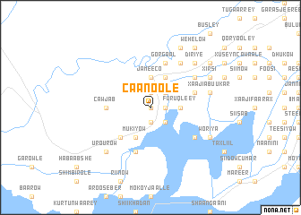
Caanoole (Shabeellaha Hoose, Somalia)Caanoole is a town in the Shabeellaha Hoose region of Somalia. An overview map of the region around Caanoole is displayed below.
regional and 3d topo map of Caanoole, Somalia ::
Nearby towns ::
Balow (0.0km north) //
Dhallmaanyoley (1.9km north) //
Doon Idow (1.9km south) //
Bambaaso Mahdi (1.9km south) //
Doon Buraale (1.9km east) //
Cabdi Abuukar (1.9km east) //
Wadajir (2.6km north east) //
Bandar Jadiid (2.6km south east) //
Carmooy (3.7km north) //
Jameeco (3.7km north) //
Furuqleey (3.7km east) //
Dhiiqooley (4.1km north east) //
Mukiyow (4.1km south west) //
Kamad (4.1km south west) //
Bambaaso Kulub (5.2km south west) //
Cawjab (5.6km west) //
Axmed Gaas (5.9km east) //
Afgooye Yare (5.9km south) //
Gorgaal (5.9km north) //
Doon Bilow (5.9km north) //
Cabdi Cali (6.7km north east) //
Baqdaad (6.7km north east) //
Caanooley ”A” (6.7km north east) //
Farkeerow (6.7km north east) //
Canalow (6.7km south east) //
Galjaw (6.7km north east) //
Ceel Wareegow (6.7km north east) //
Xaaji Abuukar (7.6km east) //
Caanooley ”B” (7.6km east) //
[all distances 'as the bird flies' and approximate] 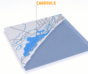 Places with similar names to Caanoole, Somalia ::
Disclaimer :: Information on this page comes without warranty of any kind |
||
|
Where is Caanoole? Elevation and coordinates ::
Latitude (lat): 1°43'0"N Longitude (lon): 44°26'0"E
Elevation (approx.): 65m (map arrows pan, magnifying glasses zoom) |
||
|
Visiting Caanoole? Hotel/Accommodation ::
Book a hotel in Caanoole Travel Guide ::
Buy a travel guide for Somalia rental cars ::
car rental offers GPS waypoint ::
download a GPX waypoint (PoI) of Caanoole for your GPS receiver
|
||