|
search place name
|
||
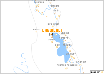
Cabdi Cali (Jubbada Dhexe, Somalia)Cabdi Cali is a town in the Jubbada Dhexe region of Somalia. An overview map of the region around Cabdi Cali is displayed below.
regional and 3d topo map of Cabdi Cali, Somalia ::
Cabdi Cali airports ::
The nearest airport is KMU - Kismayu Kisimayu, located 124.6 km south of Cabdi Cali.
Nearby towns ::
Muudey (0.0km north) //
Malenda (1.7km north east) //
Fakiya (1.9km south) //
Fanoole (2.0km north) //
Fanoole No. 1 (2.7km north east) //
Tansaani (3.1km north) //
Macalim Iman (3.8km north) //
Jiiga (4.1km south east) //
Tafanyo (4.5km east) //
Mayenda (4.8km east) //
Nasiib (4.9km east) //
Dheydhey (4.9km south east) //
Barako (5.9km west) //
Mawunde (6.7km south east) //
Cusmaan Mooto (6.7km south east) //
Kaytooy (6.8km north) //
Baqdaad (7.6km north) //
Shoongole (8.0km north) //
Wagadey (8.3km south east) //
Tarba (8.7km north) //
Geed Ful (8.8km north west) //
Munfuudhi (9.5km north) //
Dambaley (9.8km south east) //
Anduuma (10.5km south east) //
Libaanga (10.5km south east) //
Bandar (10.5km south east) //
Bodboode (10.5km south east) //
Barwaaqo (11.1km south east) //
[all distances 'as the bird flies' and approximate]  Places with similar names to Cabdi Cali, Somalia ::
// Kabūd Kolā (IR)
// Kabūd Kolā (IR)
// Gbotikale (NG)
// Kkaebat-kol (KR)
// Kobat-kol (KR)
// Cabo Docolo (MZ)
// Cabo Tiquelia (MZ)
// Cabdi Cali (SO)
// Cabatuquila (AO)
Disclaimer :: Information on this page comes without warranty of any kind |
||
|
Where is Cabdi Cali? Elevation and coordinates ::
Latitude (lat): 0°44'0"S Longitude (lon): 42°39'0"E
Elevation (approx.): 35m (map arrows pan, magnifying glasses zoom) |
||
|
Visiting Cabdi Cali? Hotel/Accommodation ::
Book a hotel in Cabdi Cali Travel Guide ::
Buy a travel guide for Somalia rental cars ::
car rental offers GPS waypoint ::
download a GPX waypoint (PoI) of Cabdi Cali for your GPS receiver
|
||