|
search place name
|
||
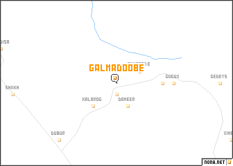
Gal Madoobe (Togdheer, Somalia)Gal Madoobe is a town in the Togdheer region of Somalia. An overview map of the region around Gal Madoobe is displayed below.
regional and 3d topo map of Gal Madoobe, Somalia ::
Gal Madoobe airports ::
The nearest airport is BBO - Berbera, located 64.9 km north west of Gal Madoobe.
Other airports nearby include HGA - Hargeisa Egal Intl (144.7 km west), Nearby towns ::
 Places with similar names to Gal Madoobe, Somalia ::
// Gouloumtouba (BF)
// Kialoumadobou (NE)
// Galamadibi (ML)
// Galamadibi (ML)
// Gaal Madoobe (SO)
// Kỳ Lam Tây (1) (VN)
Disclaimer :: Information on this page comes without warranty of any kind |
||
|
Where is Gal Madoobe? Elevation and coordinates ::
Latitude (lat): 9°57'0"N Longitude (lon): 45°20'0"E
Elevation (approx.): 1375m (map arrows pan, magnifying glasses zoom) |
||
|
Visiting Gal Madoobe? Hotel/Accommodation ::
Book a hotel in Gal Madoobe Travel Guide ::
Buy a travel guide for Somalia rental cars ::
car rental offers GPS waypoint ::
download a GPX waypoint (PoI) of Gal Madoobe for your GPS receiver
|
||