|
search place name
|
||
Hobishole (Bay, Somalia)Hobishole is a town in the Bay region of Somalia. An overview map of the region around Hobishole is displayed below.
regional and 3d topo map of Hobishole, Somalia ::
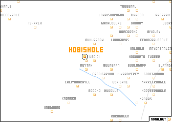
Nearby towns ::
Kormari (0.0km north) //
Dusta (1.9km south) //
Meytah (1.9km south) //
Weriri (1.9km east) //
Buklaabow (4.1km north east) //
Cabdi Garuun (5.2km south east) //
Abuukar Xaaji Figow (5.9km east) //
Buur Baan (5.9km east) //
Caliyo Marayle (5.9km south) //
Barako (7.6km south) //
Buulo Guduud (7.9km north east) //
Buulo Edeega (7.9km north east) //
Laan Garas (8.3km north east) //
Muddule (9.3km south east) //
Garal-Duure (9.3km north east) //
Gorisane (9.3km south east) //
Buulo Yuusuf (10.5km north east) //
[all distances 'as the bird flies' and approximate] 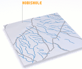 Places with similar names to Hobishole, Somalia ::
Disclaimer :: Information on this page comes without warranty of any kind |
||
|
Where is Hobishole? Elevation and coordinates ::
Latitude (lat): 2°59'0"N Longitude (lon): 43°21'0"E
Elevation (approx.): 487m (map arrows pan, magnifying glasses zoom) |
||
|
Visiting Hobishole? Hotel/Accommodation ::
Book a hotel in Hobishole Travel Guide ::
Buy a travel guide for Somalia rental cars ::
car rental offers GPS waypoint ::
download a GPX waypoint (PoI) of Hobishole for your GPS receiver
|
||