|
search place name
|
||
Kulanta Shancawo (Shabeellaha Hoose, Somalia)Kulanta Shancawo is a town in the Shabeellaha Hoose region of Somalia. An overview map of the region around Kulanta Shancawo is displayed below.
regional and 3d topo map of Kulanta Shancawo, Somalia ::
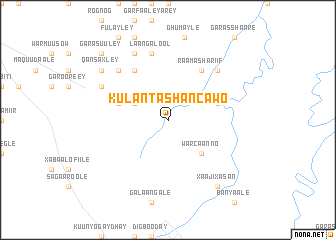
Nearby towns ::
Erilay (4.1km north west) //
War Caanno (5.2km south east) //
Diidow (5.9km east) //
Ay Buuraaley (5.9km west) //
Oodlay (6.7km north west) //
Fulaydheer (6.7km north west) //
Raama Shariif (6.7km north east) //
Laangalool (7.6km north) //
Dhaysiya (7.9km north west) //
Islow Geedi (7.9km north east) //
Dhumay Uusle (8.3km north west) //
Garas Buule (8.3km north west) //
Garas Weyne (8.3km north west) //
Xaaji Xasan (9.3km south east) //
Qansaxley (9.3km north west) //
Garasuuley (10.5km north west) //
[all distances 'as the bird flies' and approximate] 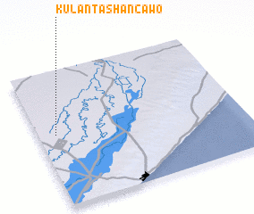 Places with similar names to Kulanta Shancawo, Somalia :: Disclaimer :: Information on this page comes without warranty of any kind |
||
|
Where is Kulanta Shancawo? Elevation and coordinates ::
Latitude (lat): 2°32'0"N Longitude (lon): 45°5'0"E
Elevation (approx.): 92m (map arrows pan, magnifying glasses zoom) |
||
|
Visiting Kulanta Shancawo? Hotel/Accommodation ::
Book a hotel in Kulanta Shancawo Travel Guide ::
Buy a travel guide for Somalia rental cars ::
car rental offers GPS waypoint ::
download a GPX waypoint (PoI) of Kulanta Shancawo for your GPS receiver
|
||