|
search place name
|
||
Loowiloy (Bay, Somalia)Loowiloy is a town in the Bay region of Somalia. An overview map of the region around Loowiloy is displayed below.
regional and 3d topo map of Loowiloy, Somalia ::
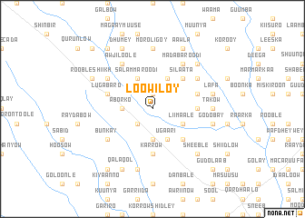
Nearby towns ::
Wagadoy (1.9km north) //
Bashmaale (2.6km south west) //
Xawaal Arundi (2.6km south west) //
Aborko (3.7km west) //
Gagso (3.7km south) //
Salam Maroodi (4.1km north west) //
Ugaari (4.1km south east) //
Kuuniyo (4.1km north east) //
Liimaale (4.1km south east) //
Galoole (5.2km south east) //
Silaata (5.2km north east) //
Karrow (5.6km south) //
Galool Tuure (5.6km east) //
Lugabaro (5.9km west) //
Gadiisaay (5.9km east) //
Bunkay (6.7km south west) //
Meene Karron (6.7km south west) //
Aw Jiloole (6.7km north west) //
Habay Gare (6.7km north west) //
Gumbi (6.7km north east) //
Mada Baroodi (6.7km north east) //
Takow (7.4km east) //
Moroligoy (7.4km north) //
Heneecada (7.6km south) //
Barabuule (7.6km south) //
Lafa (7.6km east) //
Baale (7.6km east) //
Godobay (7.6km east) //
Abaqsaarre (7.6km east) //
[all distances 'as the bird flies' and approximate] 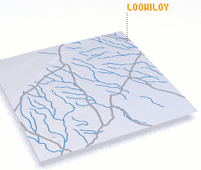 Places with similar names to Loowiloy, Somalia ::
Disclaimer :: Information on this page comes without warranty of any kind |
||
|
Where is Loowiloy? Elevation and coordinates ::
Latitude (lat): 2°54'0"N Longitude (lon): 43°59'0"E
Elevation (approx.): 231m (map arrows pan, magnifying glasses zoom) |
||
|
Visiting Loowiloy? Hotel/Accommodation ::
Book a hotel in Loowiloy Travel Guide ::
Buy a travel guide for Somalia rental cars ::
car rental offers GPS waypoint ::
download a GPX waypoint (PoI) of Loowiloy for your GPS receiver
|
||