|
search place name
|
||
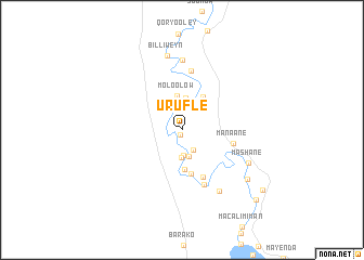
Urufle (Jubbada Dhexe, Somalia)Urufle is a town in the Jubbada Dhexe region of Somalia. An overview map of the region around Urufle is displayed below.
regional and 3d topo map of Urufle, Somalia ::
Urufle airports ::
The nearest airport is KMU - Kismayu Kisimayu, located 137.4 km south of Urufle.
Nearby towns ::
Raxoole (0.5km south west) //
Shangaani (2.4km south east) //
Berdaale (2.6km north) //
Iidow (2.6km south) //
Mabaarag (2.8km south) //
Jilaalow (2.8km south) //
Macalim Weyn (3.3km north) //
Moloolow (3.5km north) //
Farbiito (4.0km north east) //
Madiina (4.1km south) //
Xasow (4.6km south) //
Munfuudhi (5.4km south east) //
Manaane (5.4km east) //
Geed Ful (6.1km south) //
Washaan (6.2km north) //
Kaskey (7.2km north) //
Baqdaad (7.4km south east) //
Mashane (7.7km south east) //
Billi Weyn (7.8km north) //
Tarba (8.4km south east) //
Shoongole (10.3km south east) //
Kaytooy (10.4km south east) //
[all distances 'as the bird flies' and approximate] 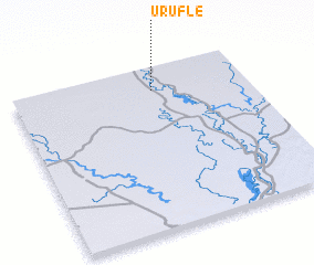 Places with similar names to Urufle, Somalia ::
Disclaimer :: Information on this page comes without warranty of any kind |
||
|
Where is Urufle? Elevation and coordinates ::
Latitude (lat): 0°51'25"S Longitude (lon): 42°35'54"E
Elevation (approx.): 37m (map arrows pan, magnifying glasses zoom) |
||
|
Visiting Urufle? Hotel/Accommodation ::
Book a hotel in Urufle Travel Guide ::
Buy a travel guide for Somalia rental cars ::
car rental offers GPS waypoint ::
download a GPX waypoint (PoI) of Urufle for your GPS receiver
|
||