|
search place name
|
||
Xaabley (Shabeellaha Dhexe, Somalia)Xaabley is a town in the Shabeellaha Dhexe region of Somalia. An overview map of the region around Xaabley is displayed below.
regional and 3d topo map of Xaabley, Somalia ::
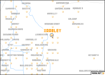
Nearby towns ::
Giir Weyne (0.0km north) //
Buulo Dheer (1.9km east) //
Buulo Macallim (1.9km south) //
Jiiq (2.6km south east) //
Caddaan Camey (2.6km south east) //
Kor Cad (2.6km south west) //
Buulo Afrax (2.6km south west) //
Aroos Beenaat (3.7km north) //
Leebo Xeero (3.7km west) //
Buulo Ganaay (4.1km south west) //
Buulo Garas (5.2km south west) //
Sakhiiro (5.6km south) //
Kaadheerey (5.6km south) //
Garaska Aw Jeelle (5.9km south) //
Cumar Cusmaan (5.9km south) //
Buulo Makiino (6.7km south west) //
Jilyaale (6.7km south west) //
Buulo Moobleen (6.7km south west) //
Faylogooye (6.7km south west) //
Waraxley (7.4km north) //
Xaanooley (7.6km west) //
Buulo Balley (7.6km south) //
Cali Alwaan (7.9km south west) //
Buulo Maxamuud Aadan (8.3km south west) //
Gal Goof (9.3km north east) //
Madiina Cad (9.3km south west) //
[all distances 'as the bird flies' and approximate] 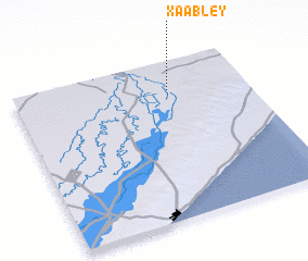 Places with similar names to Xaabley, Somalia ::
Disclaimer :: Information on this page comes without warranty of any kind |
||
|
Where is Xaabley? Elevation and coordinates ::
Latitude (lat): 2°49'0"N Longitude (lon): 45°40'0"E
Elevation (approx.): 104m (map arrows pan, magnifying glasses zoom) |
||
|
Visiting Xaabley? Hotel/Accommodation ::
Book a hotel in Xaabley Travel Guide ::
Buy a travel guide for Somalia rental cars ::
car rental offers GPS waypoint ::
download a GPX waypoint (PoI) of Xaabley for your GPS receiver
|
||