|
search place name
|
||
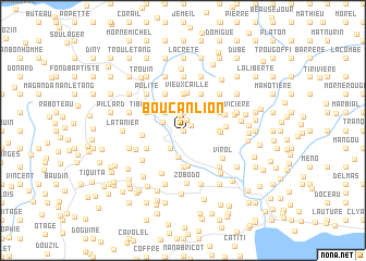
Boucan Lion (Ouest, Haiti)Boucan Lion is a town in the Ouest region of Haiti. An overview map of the region around Boucan Lion is displayed below.
regional and 3d topo map of Boucan Lion, Haiti ::
Boucan Lion airports ::
The nearest airport is PAP - Port-au-prince Toussaint Louverture Intl, located 45.0 km north east of Boucan Lion.
Other airports nearby include BRX - Barahona Maria Montez Intl (158.4 km east), CAP - Cap Haitien Intl (162.9 km north), Nearby towns ::
Mapou Langloire (0.0km north) //
Nouvelle Terre (0.9km north east) //
Rechalet (1.2km north) //
Gilbert (1.6km north) //
Platon (1.9km north) //
Morne Cassé (1.9km north) //
Réserve (2.1km north west) //
Rideau (2.2km south west) //
Carry (2.6km north west) //
Tapion (2.6km north west) //
Boucicaut (2.8km south) //
Pégui (3.6km south) //
Ca Mando (3.7km north) //
Soucaille (3.7km north) //
Bichotte (3.5km east) //
Bouc Palmistre (3.7km south) //
Castel (3.6km east) //
Vieux Caille (3.8km north) //
Bolière (4.1km north west) //
Fond Polite (4.1km north west) //
Pain de Sucre (4.1km north west) //
Ti Bon Dieu (4.0km north west) //
Gris-Gris (4.1km north east) //
Dodel (4.1km north east) //
Platon Tapion (4.1km north east) //
La Porte (4.1km north east) //
Docaut (4.0km south west) //
Tamette (4.0km north east) //
Coq Chant Cangreux (4.0km north east) //
[all distances 'as the bird flies' and approximate]  Places with similar names to Boucan Lion, Haiti ::
// Bogñalon (PH)
Disclaimer :: Information on this page comes without warranty of any kind |
||
|
Where is Boucan Lion? Elevation and coordinates ::
Latitude (lat): 18°19'0"N Longitude (lon): 72°37'0"W
Elevation (approx.): 430m (map arrows pan, magnifying glasses zoom) |
||
|
Visiting Boucan Lion? Hotel/Accommodation ::
Book a hotel in Boucan Lion Travel Guide ::
Buy a travel guide for Haiti rental cars ::
car rental offers GPS waypoint ::
download a GPX waypoint (PoI) of Boucan Lion for your GPS receiver
|
||