|
search place name
|
||
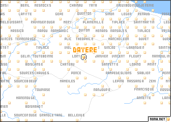
Dayere (GrandʼAnse, Haiti)Dayere is a town in the GrandʼAnse region of Haiti. An overview map of the region around Dayere is displayed below.
regional and 3d topo map of Dayere, Haiti ::
Dayere airports ::
The nearest airport is PAP - Port-au-prince Toussaint Louverture Intl, located 199.7 km east of Dayere.
Other airports nearby include GAO - Guantanamo Mariana Grajales (201.6 km north west), BCA - Baracoa Playa Gustavo Rizo (207.4 km north), SCU - Santiago De Cuba Antonio Maceo Intl (236.7 km north west), CAP - Cap Haitien Intl (248.8 km north east), Nearby towns ::
Pinquière (0.0km north) //
Bambou (1.9km north) //
Bellevue (1.9km north) //
Martillet (1.8km east) //
La Ferme (1.8km east) //
Lory (1.8km west) //
Dublé (1.8km west) //
Colonel (1.8km west) //
Prévilé (2.6km north east) //
Débarassé (2.6km north east) //
Dorfeull (2.6km north west) //
Campagne (2.6km north west) //
Palmiste (2.6km north west) //
Saint-Jean (3.5km east) //
Janvier (3.5km east) //
Smith (3.7km north) //
Théophile (3.7km north) //
Fraise (3.7km north) //
Lifranc (3.7km north) //
Grand Dolle (3.7km south) //
Bouquette (3.7km south) //
Dasignac (3.5km west) //
Lormon (4.0km north east) //
Dayer (4.0km north east) //
Gatineau (4.1km north east) //
Dayer (4.1km north east) //
Gond (4.1km north east) //
Deslions (4.0km south east) //
Gira (4.1km north west) //
[all distances 'as the bird flies' and approximate] 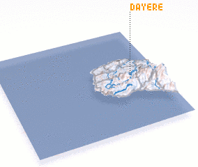 Places with similar names to Dayere, Haiti ::
Disclaimer :: Information on this page comes without warranty of any kind |
||
|
Where is Dayere? Elevation and coordinates ::
Latitude (lat): 18°31'0"N Longitude (lon): 74°11'0"W
Elevation (approx.): 445m (map arrows pan, magnifying glasses zoom) |
||
|
Visiting Dayere? Hotel/Accommodation ::
Book a hotel in Dayere Travel Guide ::
Buy a travel guide for Haiti rental cars ::
car rental offers GPS waypoint ::
download a GPX waypoint (PoI) of Dayere for your GPS receiver
|
||