|
search place name
|
||
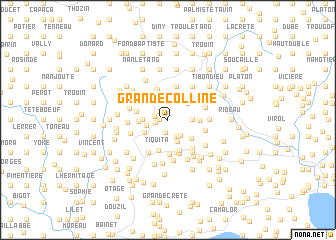
Grande Colline (Sud-Est, Haiti)Grande Colline is a town in the Sud-Est region of Haiti. An overview map of the region around Grande Colline is displayed below.
regional and 3d topo map of Grande Colline, Haiti ::
Grande Colline airports ::
The nearest airport is PAP - Port-au-prince Toussaint Louverture Intl, located 52.3 km north east of Grande Colline.
Other airports nearby include BRX - Barahona Maria Montez Intl (166.2 km east), CAP - Cap Haitien Intl (167.1 km north), Nearby towns ::
Saint-Éloi (0.9km west) //
Bodin (1.3km north west) //
Potier (1.3km west) //
Nan Fourneau (1.4km south) //
Bazile (1.4km west) //
Merac (2.0km south east) //
Abricot (2.0km south east) //
Plateau Teyen (2.2km south east) //
Gérard (2.3km north west) //
Banne Roche (2.4km west) //
Tambouye (2.6km south) //
Jacquot (2.6km east) //
Grand Fond (2.6km east) //
Séjourné (2.7km west) //
Latanier (2.8km north east) //
Moreau (2.9km south west) //
Roger (3.2km west) //
Au Tuf (3.2km south east) //
Laquête Lamarre (3.3km east) //
Tiquita (3.6km south) //
Pointe Jean Louis (3.6km south) //
David (3.6km north) //
Dodron (3.5km west) //
Arboite (3.7km south) //
Sous Fort (3.8km south) //
Pillard (3.9km north) //
Chéridant (3.9km north) //
Lapegon (3.9km north) //
Brésilienne (3.9km south) //
[all distances 'as the bird flies' and approximate]  Places with similar names to Grande Colline, Haiti ::
// Garind Kalān (IN)
// Grande Colline (HT)
Disclaimer :: Information on this page comes without warranty of any kind |
||
|
Where is Grande Colline? Elevation and coordinates ::
Latitude (lat): 18°17'58"N Longitude (lon): 72°41'29"W
Elevation (approx.): 682m (map arrows pan, magnifying glasses zoom) |
||
|
Visiting Grande Colline? Hotel/Accommodation ::
Book a hotel in Grande Colline Travel Guide ::
Buy a travel guide for Haiti rental cars ::
car rental offers GPS waypoint ::
download a GPX waypoint (PoI) of Grande Colline for your GPS receiver
|
||