|
search place name
|
||
Jolibois (GrandʼAnse, Haiti)Jolibois is a town in the GrandʼAnse region of Haiti. An overview map of the region around Jolibois is displayed below.
regional and 3d topo map of Jolibois, Haiti ::

Jolibois airports ::
The nearest airport is PAP - Port-au-prince Toussaint Louverture Intl, located 126.4 km east of Jolibois.
Other airports nearby include CAP - Cap Haitien Intl (195.0 km north east), BCA - Baracoa Playa Gustavo Rizo (236.0 km north west), GAO - Guantanamo Mariana Grajales (251.2 km north west), Nearby towns ::
Ka Raymond (0.0km north) //
Débouché (1.8km east) //
Au Saut (1.8km east) //
Bayado (1.9km north) //
Chariot (1.9km south) //
Saut (2.6km south east) //
Terre Rouge (2.6km south east) //
Pascal (2.6km north west) //
Fleurant (2.6km south west) //
Pino (2.9km south west) //
Carrefour Cadet (3.7km north) //
Pini (3.7km south) //
Lièvre (3.7km south) //
Riche (3.9km west) //
Ka Boffe (4.0km north east) //
Tomarin (4.0km south east) //
Fèvre (4.1km north west) //
Carrefour Moincon (4.1km south east) //
Moincon (4.1km south east) //
Poinceau (4.0km south west) //
Carrefour Michel (4.5km south west) //
Gastel (4.7km west) //
Carrefour Lundi (5.1km north east) //
Bonnette (5.1km south east) //
Delmas (5.1km south east) //
Les Rois (5.1km north west) //
La Porte (5.1km south west) //
Acul des Savannes (5.3km east) //
Dion (5.3km east) //
[all distances 'as the bird flies' and approximate] 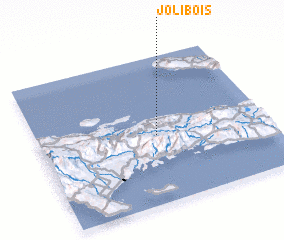 Places with similar names to Jolibois, Haiti ::
Disclaimer :: Information on this page comes without warranty of any kind |
||
|
Where is Jolibois? Elevation and coordinates ::
Latitude (lat): 18°28'0"N Longitude (lon): 73°29'0"W
Elevation (approx.): 171m (map arrows pan, magnifying glasses zoom) |
||
|
Visiting Jolibois? Hotel/Accommodation ::
Book a hotel in Jolibois Travel Guide ::
Buy a travel guide for Haiti rental cars ::
car rental offers GPS waypoint ::
download a GPX waypoint (PoI) of Jolibois for your GPS receiver
|
||