|
search place name
|
||
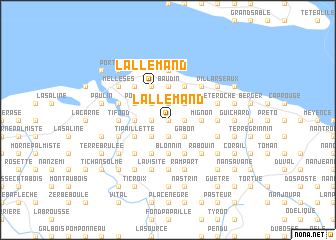
Lallemand (Nord-Ouest, Haiti)Lallemand is a town in the Nord-Ouest region of Haiti. An overview map of the region around Lallemand is displayed below.
regional and 3d topo map of Lallemand, Haiti ::
Lallemand airports ::
The nearest airport is CAP - Cap Haitien Intl, located 64.4 km east of Lallemand.
Other airports nearby include IGA - Matthew Town (150.5 km north west), PAP - Port-au-prince Toussaint Louverture Intl (155.0 km south), BCA - Baracoa Playa Gustavo Rizo (187.4 km west), PLS - Providenciales (214.3 km north), Nearby towns ::
Loterie (NaNkm north) //
Trois Pavillons (NaNkm north) //
La Galome (1.7km east) //
Grande Plaine (1.7km east) //
Nan Robert (1.9km south) //
Ca China (1.7km west) //
Nan Masse (1.9km north) //
Gabon (2.5km south east) //
La Calombe (2.5km north east) //
Nan Volsi (2.5km north east) //
Richemond (2.5km south west) //
Mare Denis (2.5km north west) //
La Croix (2.5km north west) //
Bellevue (3.5km east) //
Mignon (3.5km east) //
La Ressource (3.5km east) //
Fond Moreau (3.5km east) //
Blonnin (3.7km south) //
Baudin (3.7km north) //
Bras Homme (3.7km north) //
Ballade (3.5km west) //
Mignon (4.1km south east) //
Mainville (4.1km south east) //
Lavaud (4.1km north east) //
Grande Paillette (4.1km south west) //
Madelon (4.1km north west) //
Déroulin (4.1km north west) //
Lallemand (4.1km north west) //
La Désir (3.9km south west) //
[all distances 'as the bird flies' and approximate]  Places with similar names to Lallemand, Haiti ::
Disclaimer :: Information on this page comes without warranty of any kind |
||
|
Where is Lallemand? Elevation and coordinates ::
Latitude (lat): 19°54'0"N Longitude (lon): 72°47'0"W
Elevation (approx.): 470m (map arrows pan, magnifying glasses zoom) |
||
|
Visiting Lallemand? Hotel/Accommodation ::
Book a hotel in Lallemand Travel Guide ::
Buy a travel guide for Haiti rental cars ::
car rental offers GPS waypoint ::
download a GPX waypoint (PoI) of Lallemand for your GPS receiver
|
||