|
search place name
|
||
Laventin (GrandʼAnse, Haiti)Laventin is a town in the GrandʼAnse region of Haiti. An overview map of the region around Laventin is displayed below.
regional and 3d topo map of Laventin, Haiti ::

Laventin airports ::
The nearest airport is PAP - Port-au-prince Toussaint Louverture Intl, located 178.6 km east of Laventin.
Other airports nearby include BCA - Baracoa Playa Gustavo Rizo (211.9 km north), GAO - Guantanamo Mariana Grajales (213.1 km north west), CAP - Cap Haitien Intl (231.4 km north east), SCU - Santiago De Cuba Antonio Maceo Intl (252.6 km north west), Nearby towns ::
Flandre (1.0km south) //
Fond Ragé (1.6km north east) //
La Pagru (1.8km east) //
Ka Antoine (1.8km west) //
Nan Charles (2.3km north) //
Carrefour Charles (2.3km north west) //
Ginerte (2.6km north west) //
Mouline (2.6km north west) //
La Bastille (2.6km north west) //
Fond dʼIcaque (3.2km north east) //
Nan Lacour (3.5km east) //
Roche Pierre (3.5km east) //
Mové Zafé (3.7km north) //
Dilagon (3.7km south) //
Petit-Mil (3.7km south) //
Chardonnette (3.5km west) //
Roche Miel (3.7km north east) //
La Chicotte (4.0km north) //
Nan Coq (4.0km south east) //
Geffrard (4.0km south east) //
Digoterie (4.0km south east) //
Durochette (4.0km south east) //
Nan Reynal (4.1km north west) //
Poste-Moulin (4.1km north west) //
Beaumont (4.1km south east) //
Saint-Martin (4.0km north west) //
Bois Lambert (4.0km north west) //
Bois Misquette (4.1km south west) //
Mort (5.1km north) //
[all distances 'as the bird flies' and approximate] 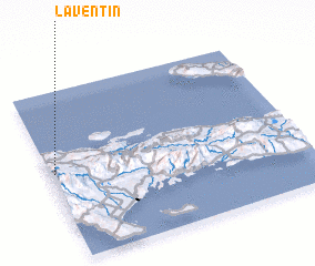 Places with similar names to Laventin, Haiti ::
// La Fontaine (CH)
// La Fontaine (US)
// Lafontaine (US)
// Le Fontane (IT)
// Leeufontein (ZA)
// Leeuwfontein (ZA)
// Leeuwfontein (ZA)
// LaVentana (US)
// Livundoni (KE)
// La Ventana (MX)
Disclaimer :: Information on this page comes without warranty of any kind |
||
|
Where is Laventin? Elevation and coordinates ::
Latitude (lat): 18°31'0"N Longitude (lon): 73°59'0"W
Elevation (approx.): 403m (map arrows pan, magnifying glasses zoom) |
||
|
Visiting Laventin? Hotel/Accommodation ::
Book a hotel in Laventin Travel Guide ::
Buy a travel guide for Haiti rental cars ::
car rental offers GPS waypoint ::
download a GPX waypoint (PoI) of Laventin for your GPS receiver
|
||