|
search place name
|
||
Nan Bambou (Ouest, Haiti)Nan Bambou is a town in the Ouest region of Haiti. An overview map of the region around Nan Bambou is displayed below.
regional and 3d topo map of Nan Bambou, Haiti ::

Nan Bambou airports ::
The nearest airport is PAP - Port-au-prince Toussaint Louverture Intl, located 31.7 km north west of Nan Bambou.
Other airports nearby include BRX - Barahona Maria Montez Intl (97.7 km east), CAP - Cap Haitien Intl (141.4 km north), STI - Santiago Cibao Intl (181.5 km north east), POP - Puerto Plata Gregorio Luperon Intl (208.8 km north east), Nearby towns ::
Trocher (0.0km north) //
Ti Place (1.3km south) //
Nan Bois Pin (1.8km west) //
Pongnon (1.8km west) //
Ka Zabeth (1.8km west) //
Matanier (1.8km east) //
Mare Ti Jardin (1.9km south) //
Ca Louis (1.9km south) //
Trou Mirliton (1.8km east) //
Mare Piquant (1.9km south) //
Ti Fond (2.3km west) //
Nan Dauphine (2.6km south west) //
Peter (2.6km south west) //
Mare Radar (2.6km south west) //
Source Gabriel (2.6km north east) //
Pot de Chambre (2.6km south east) //
Pays Pourris (2.6km south east) //
Terre Pierre (3.5km south) //
Saut dʼEau (3.5km west) //
Lifèbre (3.5km west) //
Au Codot (3.7km south) //
Terre Contrée (4.1km north west) //
Pain de Sucre (4.0km south west) //
Grand État (4.0km south west) //
Pain Ganot (4.1km north east) //
Ti Guinin (4.1km south west) //
Sainte-Rose (4.1km south west) //
Ca Fourmi (4.1km south east) //
Lerocher (4.0km south east) //
[all distances 'as the bird flies' and approximate] 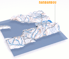 Places with similar names to Nan Bambou, Haiti ::
// Neuenbaum (DE)
// Neuenbaum (DE)
// Ninabamba (PE)
// Ninabamba (PE)
// Nan Bambou (HT)
// Nan Bambou (HT)
// Nan Bambou (HT)
// Nan Bambou (HT)
// Nan Bambou (HT)
// Nan Bombe (HT)
Disclaimer :: Information on this page comes without warranty of any kind |
||
|
Where is Nan Bambou? Elevation and coordinates ::
Latitude (lat): 18°28'0"N Longitude (lon): 72°1'0"W
Elevation (approx.): 1023m (map arrows pan, magnifying glasses zoom) |
||
|
Visiting Nan Bambou? Hotel/Accommodation ::
Book a hotel in Nan Bambou Travel Guide ::
Buy a travel guide for Haiti rental cars ::
car rental offers GPS waypoint ::
download a GPX waypoint (PoI) of Nan Bambou for your GPS receiver
|
||