|
search place name
|
||
Nan Cotton (Nord-Est, Haiti)Nan Cotton is a town in the Nord-Est region of Haiti. An overview map of the region around Nan Cotton is displayed below.
regional and 3d topo map of Nan Cotton, Haiti ::

Nan Cotton airports ::
The nearest airport is CAP - Cap Haitien Intl, located 41.4 km north west of Nan Cotton.
Other airports nearby include PAP - Port-au-prince Toussaint Louverture Intl (117.0 km south west), STI - Santiago Cibao Intl (131.7 km east), POP - Puerto Plata Gregorio Luperon Intl (136.2 km east), BRX - Barahona Maria Montez Intl (163.0 km south east), Nearby towns ::
Nan Tongui (0.0km north) //
Grande Colline (1.7km east) //
Lamothe (1.7km west) //
Morne Long (2.5km north east) //
Malterie (2.5km south east) //
Desmoulins (2.5km south east) //
Danda (2.5km north west) //
Minière (2.5km north west) //
Passe Café (3.5km east) //
Sayant (3.5km east) //
La Hatte (3.7km south) //
Savane Manigat (3.7km south) //
Petit Bourg de Danda (3.5km west) //
Dubroye (4.1km north east) //
Dumas (4.0km north east) //
Gabriel (4.1km south east) //
La Fleur (4.0km south east) //
Pied dʼOr (4.1km north west) //
Bérondi (4.1km north west) //
Destouches (4.1km north west) //
Savane Declay (4.1km south west) //
Grande Savane (4.0km south west) //
Destouches (5.1km north west) //
Briel (5.1km north west) //
Savane Cotton (5.1km south west) //
Acul Samedi (5.1km south west) //
La Baise (5.2km east) //
Gaston (5.2km east) //
Maboule (5.2km east) //
[all distances 'as the bird flies' and approximate] 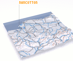 Places with similar names to Nan Cotton, Haiti ::
// Nawng-ten (MM)
// Nawngtön (MM)
// Nawngtun (MM)
// Nanga Tuan (ID)
// Nengué Dioni (GA)
// Nan Coton (HT)
// Nan Coton (HT)
// Nan Coton (HT)
// Nan Coton (HT)
// Nan Coton (HT)
Disclaimer :: Information on this page comes without warranty of any kind |
||
|
Where is Nan Cotton? Elevation and coordinates ::
Latitude (lat): 19°33'0"N Longitude (lon): 71°51'0"W
Elevation (approx.): 82m (map arrows pan, magnifying glasses zoom) |
||
|
Visiting Nan Cotton? Hotel/Accommodation ::
Book a hotel in Nan Cotton Travel Guide ::
Buy a travel guide for Haiti rental cars ::
car rental offers GPS waypoint ::
download a GPX waypoint (PoI) of Nan Cotton for your GPS receiver
|
||