|
search place name
|
||
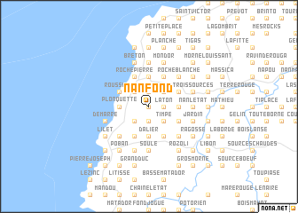
Nan Fond (GrandʼAnse, Haiti)Nan Fond is a town in the GrandʼAnse region of Haiti. An overview map of the region around Nan Fond is displayed below.
regional and 3d topo map of Nan Fond, Haiti ::
Nan Fond airports ::
The nearest airport is GAO - Guantanamo Mariana Grajales, located 189.4 km north west of Nan Fond.
Other airports nearby include BCA - Baracoa Playa Gustavo Rizo (203.1 km north), SCU - Santiago De Cuba Antonio Maceo Intl (219.2 km north west), Nearby towns ::
Merci (0.0km north) //
Duverger (0.0km north) //
Ravajou (1.9km south) //
Laton (1.8km east) //
Duchaninoir (1.8km east) //
Fondin (1.8km east) //
Dos Camp (1.9km north) //
Phare Rouge (1.9km north) //
Nan Pierri (1.8km east) //
Madame Germain (1.9km north) //
Duvineau (2.6km south west) //
Anse à Proux (2.6km south west) //
Timpe (2.6km south east) //
Plaine Martin (2.6km north west) //
Passe Barbe (2.6km north west) //
Belair (2.6km north west) //
Hatte Barbe (2.6km north east) //
Lan Pose (2.6km north east) //
Deraymond (3.5km west) //
Plonquette (3.5km west) //
Brèche (3.5km west) //
Dalier (3.7km south) //
Roux (3.5km east) //
Nicole (3.5km east) //
Trinity (3.5km east) //
Cambon (3.7km north) //
Lagon (3.7km north) //
Delbois (4.0km south east) //
Caillard (4.0km south east) //
[all distances 'as the bird flies' and approximate]  Places with similar names to Nan Fond, Haiti ::
Disclaimer :: Information on this page comes without warranty of any kind |
||
|
Where is Nan Fond? Elevation and coordinates ::
Latitude (lat): 18°32'0"N Longitude (lon): 74°24'0"W
Elevation (approx.): 76m (map arrows pan, magnifying glasses zoom) |
||
|
Visiting Nan Fond? Hotel/Accommodation ::
Book a hotel in Nan Fond Travel Guide ::
Buy a travel guide for Haiti rental cars ::
car rental offers GPS waypoint ::
download a GPX waypoint (PoI) of Nan Fond for your GPS receiver
|
||