|
search place name
|
||
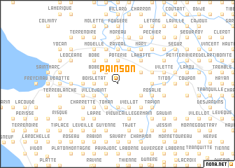
Painson (Artibonite, Haiti)Painson is a town in the Artibonite region of Haiti. An overview map of the region around Painson is displayed below.
regional and 3d topo map of Painson, Haiti ::
Painson airports ::
The nearest airport is PAP - Port-au-prince Toussaint Louverture Intl, located 66.0 km south east of Painson.
Other airports nearby include CAP - Cap Haitien Intl (82.0 km north east), BRX - Barahona Maria Montez Intl (182.2 km south east), STI - Santiago Cibao Intl (212.5 km east), IGA - Matthew Town (235.7 km north west), Nearby towns ::
Lamothe (1.8km west) //
Bois Étienne (2.5km north west) //
La Garenne (2.5km south west) //
Drouet (3.7km north) //
Coman (3.7km north) //
Poterie (3.7km north) //
Gobé (3.7km south) //
Bois lʼÉtat (3.5km west) //
Grand Fond (3.5km west) //
Marou (4.0km north east) //
Douette (4.0km north east) //
Gilbert (4.1km south east) //
Viéllot (4.1km south east) //
Bel Air (4.0km south east) //
Dessaulier (4.1km north west) //
Toman (4.1km south west) //
Bobe (4.0km north west) //
Rassemble (4.0km north west) //
Villejoint (4.0km south west) //
Janain (4.0km south west) //
Guichamp (4.0km south west) //
La Hatte (5.1km north east) //
Bimani (5.1km south east) //
Bobe (5.1km north west) //
Henry (5.1km south west) //
Bellevue (5.1km south west) //
Raynal (5.6km north) //
Mahous (5.3km east) //
La Voûte (5.3km east) //
[all distances 'as the bird flies' and approximate] 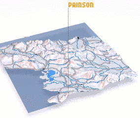 Places with similar names to Painson, Haiti ::
Disclaimer :: Information on this page comes without warranty of any kind |
||
|
Where is Painson? Elevation and coordinates ::
Latitude (lat): 19°6'0"N Longitude (lon): 72°36'0"W
Elevation (approx.): 251m (map arrows pan, magnifying glasses zoom) |
||
|
Visiting Painson? Hotel/Accommodation ::
Book a hotel in Painson Travel Guide ::
Buy a travel guide for Haiti rental cars ::
car rental offers GPS waypoint ::
download a GPX waypoint (PoI) of Painson for your GPS receiver
|
||