|
search place name
|
||
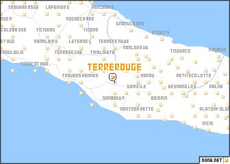
Terre Rouge (Ouest, Haiti)Terre Rouge is a town in the Ouest region of Haiti. An overview map of the region around Terre Rouge is displayed below.
regional and 3d topo map of Terre Rouge, Haiti ::
Terre Rouge airports ::
The nearest airport is PAP - Port-au-prince Toussaint Louverture Intl, located 80.2 km east of Terre Rouge.
Other airports nearby include CAP - Cap Haitien Intl (134.7 km north east), BRX - Barahona Maria Montez Intl (209.2 km east), BCA - Baracoa Playa Gustavo Rizo (233.3 km north west), MOA - Moa Orestes Acosta (286.4 km north west), Nearby towns ::
Dielgo (0.0km north) //
Bois Pin (0.0km north) //
Plaisance (0.0km north) //
Mouri Corps (1.9km south) //
Ti Palmiste (2.6km north west) //
Dados (2.6km north east) //
Lottore (2.6km south east) //
Nan Bœuf (3.7km south) //
Derrière Marc (3.5km east) //
Nan Café (3.6km east) //
Ti Palmiste (4.1km north west) //
Bouzillette (4.0km north west) //
Madame Legros (4.0km north west) //
LʼAutre Bord de lʼEau (4.0km north east) //
Bois Brûlé (4.0km north east) //
Domicile (4.0km south east) //
Bois Verna (5.1km south west) //
Trou Pélé (5.1km north east) //
Morne La Pierre (5.1km south east) //
Mahotière (5.3km west) //
Trou des Hommes (5.3km west) //
Mapou (5.3km east) //
Mantenoir (5.3km east) //
Terre Fendue (5.6km north) //
Abricot (5.6km north) //
Nan Lavaud (5.6km north east) //
Ti Fort Nègre (5.8km north) //
Ca Léon (5.8km north) //
Fleurant (5.6km west) //
[all distances 'as the bird flies' and approximate]  Places with similar names to Terre Rouge, Haiti ::
// Dry Ridge (US)
// Dry Ridge (US)
// Driorejo (ID)
// Terre Rouge (GF)
// Terre Rouge (GF)
// Terre Rouge (HT)
// Terre Rouge (HT)
// Terre Rouge (HT)
// Terre Rouge (HT)
// Terre Rouge (HT)
Disclaimer :: Information on this page comes without warranty of any kind |
||
|
Where is Terre Rouge? Elevation and coordinates ::
Latitude (lat): 18°48'0"N Longitude (lon): 73°1'0"W
Elevation (approx.): 528m (map arrows pan, magnifying glasses zoom) |
||
|
Visiting Terre Rouge? Hotel/Accommodation ::
Book a hotel in Terre Rouge Travel Guide ::
Buy a travel guide for Haiti rental cars ::
car rental offers GPS waypoint ::
download a GPX waypoint (PoI) of Terre Rouge for your GPS receiver
|
||