|
search place name
|
||
Tomarin (Ouest, Haiti)Tomarin is a town in the Ouest region of Haiti. An overview map of the region around Tomarin is displayed below.
regional and 3d topo map of Tomarin, Haiti ::

Tomarin airports ::
The nearest airport is PAP - Port-au-prince Toussaint Louverture Intl, located 104.3 km east of Tomarin.
Other airports nearby include CAP - Cap Haitien Intl (140.3 km north east), BCA - Baracoa Playa Gustavo Rizo (209.8 km north west), GAO - Guantanamo Mariana Grajales (241.4 km north west), MOA - Moa Orestes Acosta (262.5 km north west), Nearby towns ::
Plaine Jeannis (1.8km west) //
Herbe à Bleu (1.9km south) //
Morne Ti Paul (1.8km east) //
Nan Tida (2.6km north west) //
Morne Barroque (2.6km south west) //
Plaine la Source (2.6km north east) //
Morne Minthor (2.6km north east) //
Nan Jésus (2.6km south east) //
Ti Fond (3.5km west) //
Platon Balais (3.7km south) //
Nan Grand Bois (3.5km east) //
Pointe des Lataniers (4.1km north west) //
Ti Fond (4.0km north west) //
Plaine Jeannis (4.0km north west) //
Grand Vide (4.0km south west) //
Plaine Afio (4.0km north east) //
Nan Cour (4.1km south east) //
Lan Gaiac (4.1km south east) //
Nan Bœuf (4.0km south east) //
Nanterretiste (4.0km south east) //
Nan Ti Bois (4.0km south east) //
Langue Blanche (5.1km north west) //
Grand Boucan (5.1km south west) //
Évangéliste (5.1km north east) //
Platon Trou Louis (5.1km south east) //
Zoranger (5.1km south east) //
Belle Platon (5.3km east) //
Nan Francind (5.3km east) //
Platon Balais (5.3km east) //
[all distances 'as the bird flies' and approximate] 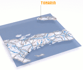 Places with similar names to Tomarin, Haiti ::
Disclaimer :: Information on this page comes without warranty of any kind |
||
|
Where is Tomarin? Elevation and coordinates ::
Latitude (lat): 18°55'0"N Longitude (lon): 73°13'0"W
Elevation (approx.): 287m (map arrows pan, magnifying glasses zoom) |
||
|
Visiting Tomarin? Hotel/Accommodation ::
Book a hotel in Tomarin Travel Guide ::
Buy a travel guide for Haiti rental cars ::
car rental offers GPS waypoint ::
download a GPX waypoint (PoI) of Tomarin for your GPS receiver
|
||