|
search place name
|
||
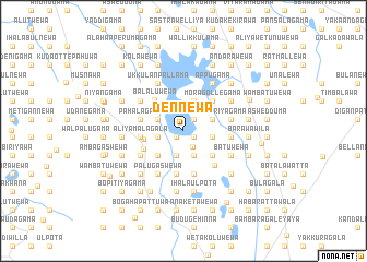
Dennewa (North Central, Sri Lanka)Dennewa is a town in the North Central region of Sri Lanka. An overview map of the region around Dennewa is displayed below.
regional and 3d topo map of Dennewa, Sri Lanka ::
Dennewa airports ::
The nearest airport is TRR - Trinciomalee China Bay, located 94.3 km north east of Dennewa.
Other airports nearby include CMB - Bandaranaike Intl Colombo (113.4 km south west), GOY - Galoya Amparai (136.4 km south east), RML - Colombo Ratmalana (145.6 km south west), JAF - Jaffna Kankesanturai (210.1 km north), Nearby towns ::
Alutwewa (1.0km south west) //
Undurawa (1.3km south east) //
Wirandawatawana (1.6km north east) //
Dambewatawana (1.6km north east) //
Galkeeriyagama (1.8km south east) //
Pahaminiyagama (2.6km south) //
Kodikaragama (2.6km south) //
Dikwannawa (2.6km south) //
Kuda Hettiyawa (2.7km west) //
Maha Hettiyawa (2.7km west) //
Ikiripotana (2.7km west) //
Kawatewa (2.7km west) //
Kuriyagama (2.7km south east) //
Daniyagama (2.7km south east) //
Gallenawatta (2.7km south east) //
Radagamawatta (2.7km south east) //
Mirihenpitigama (2.8km north west) //
Undurawa Hammillewa (3.0km east) //
Kadadekawewa (3.0km east) //
Lokunaidagama (3.0km east) //
Kudagama (3.0km east) //
Sakalasuriyagama (3.2km east) //
Nankuriyagama (3.2km east) //
Kuda Daniya (3.2km east) //
Kahambiliyawatawana (3.3km north) //
Kuda Hammillewa (3.6km south west) //
Kirindiwaththa (3.6km south west) //
Katukeliyawa (3.9km south east) //
Hammillewa (4.1km west) //
[all distances 'as the bird flies' and approximate] 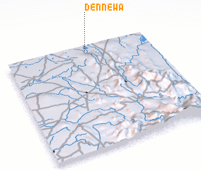 Places with similar names to Dennewa, Sri Lanka ::
Disclaimer :: Information on this page comes without warranty of any kind |
||
|
Where is Dennewa? Elevation and coordinates ::
Latitude (lat): 7°57'21"N Longitude (lon): 80°33'24"E
Elevation (approx.): 136m (map arrows pan, magnifying glasses zoom) |
||
|
Visiting Dennewa? Hotel/Accommodation ::
Book a hotel in Dennewa Travel Guide ::
Buy a travel guide for Sri Lanka rental cars ::
car rental offers GPS waypoint ::
download a GPX waypoint (PoI) of Dennewa for your GPS receiver
|
||