|
search place name
|
||
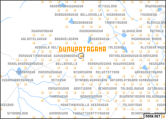
Dunupotagama (North Central, Sri Lanka)Dunupotagama is a town in the North Central region of Sri Lanka. An overview map of the region around Dunupotagama is displayed below.
regional and 3d topo map of Dunupotagama, Sri Lanka ::
Dunupotagama airports ::
The nearest airport is TRR - Trinciomalee China Bay, located 109.2 km east of Dunupotagama.
Other airports nearby include CMB - Bandaranaike Intl Colombo (124.4 km south), RML - Colombo Ratmalana (162.5 km south), JAF - Jaffna Kankesanturai (171.5 km north), GOY - Galoya Amparai (183.8 km south east), Nearby towns ::
Kiwulegama (0.0km north) //
Palugama (0.0km north) //
Migahawewa (0.0km north) //
Oluwewa (1.8km west) //
Hammillakulama (1.8km west) //
Palugahawewa (1.9km north) //
Dombawalagama (1.8km east) //
Amunukole (2.6km south west) //
Ihala Wetiyawa (2.6km north west) //
Hiriyalegama (2.6km north west) //
Badahela Ranorewa (2.6km south east) //
Dunudambuwewa (3.7km west) //
Acharigama (3.7km south) //
Nitulagama (4.1km north west) //
Pahala Keditokkuwa (4.1km south west) //
Ihala Keditokkuwa (4.1km south west) //
Pahala Wetiyawa (4.1km south west) //
Nochchiyagama (4.1km north west) //
Bellankalla (4.1km south west) //
Ihalagama (4.1km north west) //
Tanuwagamo (4.1km south east) //
Sinharagama (4.1km north east) //
Relapanawewa (4.1km north east) //
Potanegama (4.1km south east) //
Diwulwewa (4.1km south east) //
Pahamunegama (4.1km south east) //
Badahelagama (5.2km north west) //
Kanduwewa (5.2km north west) //
Galpadiyewa (5.2km north west) //
[all distances 'as the bird flies' and approximate]  Places with similar names to Dunupotagama, Sri Lanka ::
// Danpitigama (LK)
// Dunupotagama (LK)
// Tinipitigama (LK)
// Tinipitigama (LK)
// Tinipitigama (LK)
Disclaimer :: Information on this page comes without warranty of any kind |
||
|
Where is Dunupotagama? Elevation and coordinates ::
Latitude (lat): 8°15'0"N Longitude (lon): 80°14'0"E
Elevation (approx.): 84m (map arrows pan, magnifying glasses zoom) |
||
|
Visiting Dunupotagama? Hotel/Accommodation ::
Book a hotel in Dunupotagama Travel Guide ::
Buy a travel guide for Sri Lanka rental cars ::
car rental offers GPS waypoint ::
download a GPX waypoint (PoI) of Dunupotagama for your GPS receiver
|
||