|
search place name
|
||
Getakullawa (North Western, Sri Lanka)Getakullawa is a town in the North Western region of Sri Lanka. An overview map of the region around Getakullawa is displayed below.
regional and 3d topo map of Getakullawa, Sri Lanka ::

Getakullawa airports ::
The nearest airport is CMB - Bandaranaike Intl Colombo, located 74.4 km south west of Getakullawa.
Other airports nearby include RML - Colombo Ratmalana (105.8 km south west), TRR - Trinciomalee China Bay (133.1 km north east), GOY - Galoya Amparai (143.2 km east), Nearby towns ::
Galkanda (0.0km north) //
Waduwannegama (0.0km north) //
Konwewa (0.0km north) //
Makulmada (0.0km north) //
Hiripitiya (0.0km north) //
Paragolla (1.8km east) //
Kongolla (1.8km east) //
Dodanwatawana (1.8km east) //
Nabirittawewa (1.8km east) //
Dampelessa (1.8km east) //
Kosgolla (1.8km east) //
Malasne (1.9km north) //
Kalatuwawa (1.9km south) //
Kudakivula (1.9km north) //
Mehialagama (1.9km north) //
Galkandegama (1.9km south) //
Medagama (1.9km south) //
Rembawewa (1.9km north) //
Walpaluwa (1.9km south) //
Welikada (1.9km north) //
Hindawewa (1.8km west) //
Iswatiya (1.8km west) //
Ganewatta (1.9km west) //
Barube (2.6km south east) //
Unu-unugalyaya (2.6km north east) //
Otuwela (2.6km south east) //
Hangomuwa (2.6km north east) //
Nerawiya (2.6km north east) //
Malagamuwa (2.6km south east) //
[all distances 'as the bird flies' and approximate] 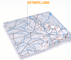 Places with similar names to Getakullawa, Sri Lanka :: Disclaimer :: Information on this page comes without warranty of any kind |
||
|
Where is Getakullawa? Elevation and coordinates ::
Latitude (lat): 7°39'0"N Longitude (lon): 80°22'0"E
Elevation (approx.): 103m (map arrows pan, magnifying glasses zoom) |
||
|
Visiting Getakullawa? Hotel/Accommodation ::
Book a hotel in Getakullawa Travel Guide ::
Buy a travel guide for Sri Lanka rental cars ::
car rental offers GPS waypoint ::
download a GPX waypoint (PoI) of Getakullawa for your GPS receiver
|
||