|
search place name
|
||
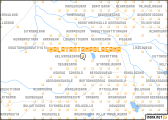
Ihala Yantampolagama (North Western, Sri Lanka)Ihala Yantampolagama is a town in the North Western region of Sri Lanka. An overview map of the region around Ihala Yantampolagama is displayed below.
regional and 3d topo map of Ihala Yantampolagama, Sri Lanka ::
Ihala Yantampolagama airports ::
The nearest airport is CMB - Bandaranaike Intl Colombo, located 105.7 km south of Ihala Yantampolagama.
Other airports nearby include TRR - Trinciomalee China Bay (119.3 km north east), RML - Colombo Ratmalana (143.7 km south), GOY - Galoya Amparai (177.6 km south east), JAF - Jaffna Kankesanturai (189.6 km north), Nearby towns ::
Gamayagama (1.9km south) //
Tambutta (1.8km east) //
Palugama (1.8km east) //
Hengogama (1.8km west) //
Pahala Yantampolagama (1.8km west) //
Kapparawelliya (2.6km south east) //
Kumbukkadawala (2.6km south east) //
Aliyawetunawewa (2.6km south east) //
Gampola Amunukole (2.6km south west) //
Elapatwewa (2.6km south east) //
Welikandegama (3.7km west) //
Maradankadawala (3.7km west) //
Galkadawala (4.1km south east) //
Medibegama (4.1km south west) //
Attikulama (4.1km south west) //
Nochchiyagama (4.1km south east) //
Hinukwewa (4.1km south east) //
Punchialiyawetunawewa (4.1km south east) //
Gampola (4.1km south west) //
Gampola Kumbukwewa (4.1km south west) //
Lokahettigama (4.1km north west) //
Tammannewa (5.2km south east) //
Bendapuwewa (5.2km south east) //
Iddamalpitiya (5.2km south east) //
Rajangane (5.2km south east) //
Adikarigama (5.2km north east) //
Kokmaduwa (5.2km north east) //
Hangiligama (5.2km north east) //
Pahala Mailewa (5.5km east) //
[all distances 'as the bird flies' and approximate] 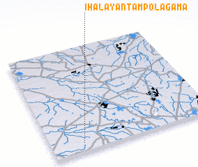 Places with similar names to Ihala Yantampolagama, Sri Lanka :: Disclaimer :: Information on this page comes without warranty of any kind |
||
|
Where is Ihala Yantampolagama? Elevation and coordinates ::
Latitude (lat): 8°5'0"N Longitude (lon): 80°12'0"E
Elevation (approx.): 95m (map arrows pan, magnifying glasses zoom) |
||
|
Visiting Ihala Yantampolagama? Hotel/Accommodation ::
Book a hotel in Ihala Yantampolagama Travel Guide ::
Buy a travel guide for Sri Lanka rental cars ::
car rental offers GPS waypoint ::
download a GPX waypoint (PoI) of Ihala Yantampolagama for your GPS receiver
|
||