|
search place name
|
||
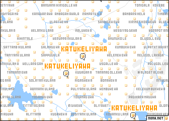
Katukeliyawa (North Central, Sri Lanka)Katukeliyawa is a town in the North Central region of Sri Lanka. An overview map of the region around Katukeliyawa is displayed below.
regional and 3d topo map of Katukeliyawa, Sri Lanka ::
Katukeliyawa airports ::
The nearest airport is TRR - Trinciomalee China Bay, located 66.9 km east of Katukeliyawa.
Other airports nearby include CMB - Bandaranaike Intl Colombo (149.4 km south west), GOY - Galoya Amparai (155.3 km south east), JAF - Jaffna Kankesanturai (173.9 km north), RML - Colombo Ratmalana (183.9 km south west), Nearby towns ::
Mayilagaswewa (1.9km north) //
Karakolawewa (1.8km east) //
Pahala Hammillewa (1.9km south) //
Konwewa (1.9km south) //
Kasamaduwa (1.8km west) //
Netiyagama (1.8km west) //
Nabadawewa (1.8km west) //
Galenbindunuwewa (2.6km north east) //
Tihogama (2.6km north east) //
Marasinhagama (2.6km north west) //
Ambagahawewa (2.6km south east) //
Periyakulama (2.6km south east) //
Ichchankulama (2.6km south east) //
Indigollewa (2.6km south west) //
Pahala Kayinattama (3.7km east) //
Niwitigama (3.7km west) //
Palugaswewa (3.7km west) //
Kudagama (3.7km south) //
Mawatawewa (3.7km south) //
Nekutunewa (4.1km north east) //
Kirimetiyawa (4.1km north west) //
Nitulgehewa (4.1km north west) //
Kuda Himbutugollewa (4.1km south east) //
Ihalagama (4.1km north west) //
Kadurugaspitiya (4.1km south east) //
Tirappane (4.1km south west) //
Rambewa (4.1km south west) //
Ihala Hammillewa (4.1km south west) //
Kudawewa (4.1km south west) //
[all distances 'as the bird flies' and approximate] 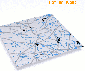 Places with similar names to Katukeliyawa, Sri Lanka ::
// Katukeliyawa (LK)
// Katukeliyawa (LK)
// Katukeliyawa (LK)
// Katukeliyawa (LK)
// Katukeliyawa (LK)
// Katukeliyawa (LK)
// Katukeliyawa (LK)
// Katukeliyawa (LK)
// Katukeliyawa (LK)
// Katukeliyawa (LK)
Disclaimer :: Information on this page comes without warranty of any kind |
||
|
Where is Katukeliyawa? Elevation and coordinates ::
Latitude (lat): 8°19'0"N Longitude (lon): 80°37'0"E
Elevation (approx.): 116m (map arrows pan, magnifying glasses zoom) |
||
|
Visiting Katukeliyawa? Hotel/Accommodation ::
Book a hotel in Katukeliyawa Travel Guide ::
Buy a travel guide for Sri Lanka rental cars ::
car rental offers GPS waypoint ::
download a GPX waypoint (PoI) of Katukeliyawa for your GPS receiver
|
||