|
search place name
|
||
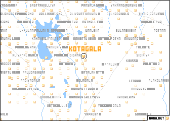
Kotagala (North Central, Sri Lanka)Kotagala is a town in the North Central region of Sri Lanka. An overview map of the region around Kotagala is displayed below.
regional and 3d topo map of Kotagala, Sri Lanka ::
Kotagala airports ::
The nearest airport is TRR - Trinciomalee China Bay, located 88.8 km north east of Kotagala.
Other airports nearby include CMB - Bandaranaike Intl Colombo (118.6 km south west), GOY - Galoya Amparai (128.8 km south east), RML - Colombo Ratmalana (149.6 km south west), JAF - Jaffna Kankesanturai (213.0 km north), Nearby towns ::
Achari Madatugama (0.0km north) //
Madatugama (0.8km south west) //
Barawawila (1.8km west) //
Pahala Madatugama (1.8km west) //
Nelbegama (1.9km north) //
Ihalagama (1.9km north) //
Debaragoda (1.9km south) //
Ihala Bakmigahaulpota (1.9km south) //
Aswedduma (1.9km north) //
Kodikaragama (1.9km south) //
Ihala Kitulhitiyawa (1.9km south) //
Dunumadalawa (2.6km south west) //
Nakattagama (2.6km north west) //
Kanadeniyagama (2.6km north west) //
Kehelwatta (2.6km south west) //
Hudaliyagama (2.6km north west) //
Ihala Bakmigahaulpota (2.6km south east) //
Palle Hingura (3.7km north) //
Murungahitikanda (3.7km north) //
Panditayagama (3.7km south) //
Pahala Bulagala (3.7km south) //
Kitulhitiyawa (3.7km south) //
Moragaswewa (3.7km south) //
Uda Hingura (3.7km north) //
Wambatuwewa (3.7km north) //
Pahala Nidigama (3.7km west) //
Konpolayagama (3.7km west) //
Batalawatta (4.1km south east) //
Etorahena (4.1km south east) //
[all distances 'as the bird flies' and approximate]  Places with similar names to Kotagala, Sri Lanka ::
Disclaimer :: Information on this page comes without warranty of any kind |
||
|
Where is Kotagala? Elevation and coordinates ::
Latitude (lat): 7°57'0"N Longitude (lon): 80°38'0"E
Elevation (approx.): 163m (map arrows pan, magnifying glasses zoom) |
||
|
Visiting Kotagala? Hotel/Accommodation ::
Book a hotel in Kotagala Travel Guide ::
Buy a travel guide for Sri Lanka rental cars ::
car rental offers GPS waypoint ::
download a GPX waypoint (PoI) of Kotagala for your GPS receiver
|
||