|
search place name
|
||
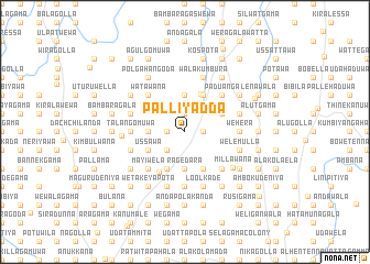
Palliyadda (North Western, Sri Lanka)Palliyadda is a town in the North Western region of Sri Lanka. An overview map of the region around Palliyadda is displayed below.
regional and 3d topo map of Palliyadda, Sri Lanka ::
Palliyadda airports ::
The nearest airport is CMB - Bandaranaike Intl Colombo, located 90.7 km south west of Palliyadda.
Other airports nearby include TRR - Trinciomalee China Bay (118.5 km north east), RML - Colombo Ratmalana (119.1 km south west), GOY - Galoya Amparai (126.5 km east), Nearby towns ::
Gurussa (1.8km west) //
Omaragolla (1.9km north) //
Hewanetenna (1.8km east) //
Nabata (2.6km south west) //
Idikadapelessa (3.7km west) //
Hapatgomuwa (3.7km west) //
Geralipitiya (3.7km south) //
Disakumbura (3.7km south) //
Ragedara (3.7km south) //
Madahapolakanda (3.7km north) //
Handawelpola (4.1km south west) //
Kadawaramulla (4.1km south west) //
Ussawa (4.1km south west) //
Makulgolla (4.1km south west) //
Megoda Diyature (4.1km south west) //
Imbulangoda (4.1km south east) //
Beligamuwa (4.1km north east) //
Hatadukkuwa (4.1km north east) //
Miriskuttawa (4.1km north east) //
Nugahapola (4.1km north east) //
Kendangamuwa (4.1km north east) //
Madipola Marakkalabage (4.1km north east) //
Hewanewela Marakkalabage (4.1km north east) //
Wegodapola (4.1km north east) //
Weralanda (4.2km north) //
Diyature Egoda (4.8km south west) //
Madahapola (4.8km north west) //
Kosmulla (5.2km south west) //
Dombagomuwa (5.2km south west) //
[all distances 'as the bird flies' and approximate] 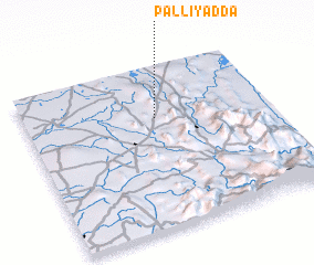 Places with similar names to Palliyadda, Sri Lanka ::
// Playita (PA)
// Pelayito (CO)
// Playeta (CO)
// Pāliyād (IN)
// Palaiyuttu (LK)
// Puliyadda (LK)
// Playita (VE)
// Playita (US)
// Playita (US)
// Plei Ya Té (VN)
Disclaimer :: Information on this page comes without warranty of any kind |
||
|
Where is Palliyadda? Elevation and coordinates ::
Latitude (lat): 7°41'0"N Longitude (lon): 80°32'0"E
Elevation (approx.): 205m (map arrows pan, magnifying glasses zoom) |
||
|
Visiting Palliyadda? Hotel/Accommodation ::
Book a hotel in Palliyadda Travel Guide ::
Buy a travel guide for Sri Lanka rental cars ::
car rental offers GPS waypoint ::
download a GPX waypoint (PoI) of Palliyadda for your GPS receiver
|
||