|
search place name
|
||
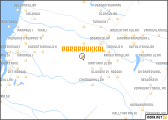
Parappukkal (North Eastern, Sri Lanka)Parappukkal is a town in the North Eastern region of Sri Lanka. An overview map of the region around Parappukkal is displayed below.
regional and 3d topo map of Parappukkal, Sri Lanka ::
Parappukkal airports ::
The nearest airport is JAF - Jaffna Kankesanturai, located 80.4 km north of Parappukkal.
Other airports nearby include TRR - Trinciomalee China Bay (120.5 km south east), CMB - Bandaranaike Intl Colombo (213.9 km south), GOY - Galoya Amparai (246.7 km south east), TRZ - Tiruchchirappalli Tiruchirappalli (250.1 km north west), Nearby towns ::
Kumiladikkulam (2.6km south east) //
Manavanchan (2.6km north east) //
Kuttimulai (3.7km north) //
Ramiyankulam (4.1km south east) //
Uluvaneri (5.2km south east) //
Oddankulam (5.2km north east) //
Komparuttakulam (5.5km east) //
Puvarasankulam (5.8km east) //
Chiraddikulam (5.9km south) //
Naddankandal (6.6km south east) //
Pandiyankulam (7.3km east) //
Kalvilan (7.4km north) //
Mallavi (7.8km north east) //
Moddai (8.2km south east) //
Panankamam (8.2km south east) //
Tunukkai (8.3km north east) //
Kothampiyakulam (8.3km north east) //
[all distances 'as the bird flies' and approximate] 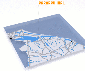 Places with similar names to Parappukkal, Sri Lanka :: Disclaimer :: Information on this page comes without warranty of any kind |
||
|
Where is Parappukkal? Elevation and coordinates ::
Latitude (lat): 9°5'0"N Longitude (lon): 80°14'0"E
Elevation (approx.): 45m (map arrows pan, magnifying glasses zoom) |
||
|
Visiting Parappukkal? Hotel/Accommodation ::
Book a hotel in Parappukkal Travel Guide ::
Buy a travel guide for Sri Lanka rental cars ::
car rental offers GPS waypoint ::
download a GPX waypoint (PoI) of Parappukkal for your GPS receiver
|
||