|
search place name
|
||
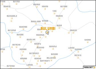
Bulumbi (Busoga, Uganda)Bulumbi is a town in the Busoga region of Uganda. An overview map of the region around Bulumbi is displayed below.
regional and 3d topo map of Bulumbi, Uganda ::
Bulumbi airports ::
The nearest airport is KIS - Kisumu, located 94.6 km south east of Bulumbi.
Other airports nearby include KTL - Kitale (115.8 km north east), EDL - Eldoret Intl (131.2 km east), SRT - Soroti (150.2 km north), EBB - Entebbe Intl (185.4 km west), Nearby towns ::
Dabani (1.3km south west) //
Busia (2.1km north east) //
Buwumba (2.8km west) //
Mawanga (3.3km west) //
Sikuda (4.6km north) //
Busia (5.1km north east) //
Bumunji (5.9km south) //
Masafu (6.1km south west) //
Bumulimba (6.3km north west) //
Busikho (6.7km south west) //
Bukaliha (7.2km south west) //
Mawero (7.7km north east) //
Lwero (8.1km east) //
Tira (8.5km north) //
Busobo (8.9km south) //
Bukhasaba (9.0km south) //
Butangazi (9.9km south west) //
[all distances 'as the bird flies' and approximate] 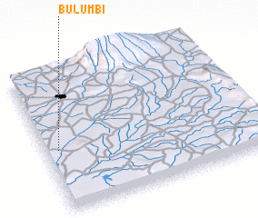 Places with similar names to Bulumbi, Uganda ::
Disclaimer :: Information on this page comes without warranty of any kind |
||
|
Where is Bulumbi? Elevation and coordinates ::
Latitude (lat): 0°26'36"S Longitude (lon): 34°3'39"E
Elevation (approx.): 1238m (map arrows pan, magnifying glasses zoom) |
||
|
Visiting Bulumbi? Hotel/Accommodation ::
Book a hotel in Bulumbi Travel Guide ::
Buy a travel guide for Uganda rental cars ::
car rental offers GPS waypoint ::
download a GPX waypoint (PoI) of Bulumbi for your GPS receiver
|
||