|
search place name
|
||
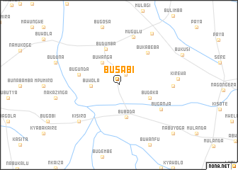
Busabi (Busoga, Uganda)Busabi is a town in the Busoga region of Uganda. An overview map of the region around Busabi is displayed below.
regional and 3d topo map of Busabi, Uganda ::
Busabi airports ::
The nearest airport is SRT - Soroti, located 109.7 km north of Busabi.
Other airports nearby include KTL - Kitale (122.9 km east), KIS - Kisumu (134.2 km south east), EDL - Eldoret Intl (157.2 km east), EBB - Entebbe Intl (178.3 km south west), Nearby towns ::
Manyami (2.0km north east) //
Buwanga (4.4km north west) //
Buwola (4.5km west) //
Bubada (5.2km south) //
Budaka (5.2km south east) //
Budumba (6.0km north) //
Bugunda (6.5km west) //
Bukabeba (6.8km north east) //
Buganja (7.7km south east) //
Mugulu (7.9km north) //
Kisiro (8.5km south west) //
Soni (8.5km east) //
Busolwe (9.6km north east) //
Nabuyoga (11.4km south east) //
[all distances 'as the bird flies' and approximate]  Places with similar names to Busabi, Uganda ::
Disclaimer :: Information on this page comes without warranty of any kind |
||
|
Where is Busabi? Elevation and coordinates ::
Latitude (lat): 0°46'6"S Longitude (lon): 33°52'24"E
Elevation (approx.): 1099m (map arrows pan, magnifying glasses zoom) |
||
|
Visiting Busabi? Hotel/Accommodation ::
Book a hotel in Busabi Travel Guide ::
Buy a travel guide for Uganda rental cars ::
car rental offers GPS waypoint ::
download a GPX waypoint (PoI) of Busabi for your GPS receiver
|
||