|
search place name
|
||
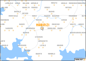
Mabirizi (Busoga, Uganda)Mabirizi is a town in the Busoga region of Uganda. An overview map of the region around Mabirizi is displayed below.
regional and 3d topo map of Mabirizi, Uganda ::
Mabirizi airports ::
The nearest airport is EBB - Entebbe Intl, located 129.4 km west of Mabirizi.
Other airports nearby include KIS - Kisumu (141.8 km east), SRT - Soroti (147.0 km north), KTL - Kitale (169.1 km east), EDL - Eldoret Intl (188.0 km east), Nearby towns ::
Kaluba (3.7km west) //
Bulyangada (3.7km north) //
Namalege (3.7km east) //
Musima (4.1km north west) //
Kiterera (4.1km south west) //
Wakawungu (5.6km west) //
Wandegeya (5.6km south) //
Busenda (5.6km south) //
Nvunwa (5.9km north) //
Nakazigo (5.9km east) //
Mpungwe (6.7km north west) //
Mwezi (6.7km north west) //
Lutale (7.4km south) //
Nsone (7.4km east) //
Bulembu (7.6km south) //
Busaka (7.6km west) //
Bugunda (7.9km north east) //
Busimo (8.3km north east) //
Mayuge (10.2km north west) //
Ikulwe (10.4km north west) //
Kikoma (10.5km south west) //
Makoma (10.5km south east) //
Bugoto (10.5km south east) //
[all distances 'as the bird flies' and approximate] 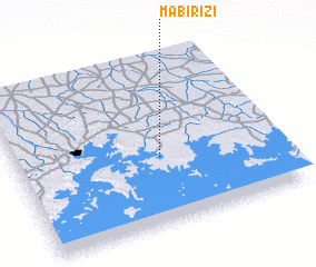
Disclaimer :: Information on this page comes without warranty of any kind |
||
|
Where is Mabirizi? Elevation and coordinates ::
Latitude (lat): 0°24'0"S Longitude (lon): 33°33'0"E
Elevation (approx.): 1223m (map arrows pan, magnifying glasses zoom) |
||
|
Visiting Mabirizi? Hotel/Accommodation ::
Book a hotel in Mabirizi Travel Guide ::
Buy a travel guide for Uganda rental cars ::
car rental offers GPS waypoint ::
download a GPX waypoint (PoI) of Mabirizi for your GPS receiver
|
||