|
search place name
|
||
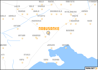
Nabusanke (Mpigi, Uganda)Nabusanke is a town in the Mpigi region of Uganda. An overview map of the region around Nabusanke is displayed below.
regional and 3d topo map of Nabusanke, Uganda ::
Nabusanke airports ::
The nearest airport is EBB - Entebbe Intl, located 46.7 km east of Nabusanke.
Other airports nearby include SRT - Soroti (260.1 km north east), BUX - Bunia (264.3 km north west), KGL - Kigali Intl (303.3 km south west), Nearby towns ::
Nkozi (1.5km south west) //
Busese (2.6km north) //
Munkasi (2.6km north) //
Kawango (4.8km west) //
Buganga (5.1km west) //
Jandira (5.1km south) //
Mwererwe (6.3km north west) //
Kituntu (6.7km north west) //
Bezinya (7.8km north east) //
Luwunga (8.1km north) //
Katebo (8.2km south east) //
Busebwe (8.4km east) //
Sakabusolo (8.5km north) //
Bwala (9.2km north west) //
Namasawo (9.3km north east) //
Sango (9.4km north east) //
Buwama (9.7km north east) //
Mitala Maria (11.5km north east) //
Kifamba (11.5km north west) //
Buwere (11.6km north east) //
Ntirizi (12.0km south west) //
[all distances 'as the bird flies' and approximate]  Places with similar names to Nabusanke, Uganda ::
// Nabasonogo (BF)
// New Busuanga (PH)
Disclaimer :: Information on this page comes without warranty of any kind |
||
|
Where is Nabusanke? Elevation and coordinates ::
Latitude (lat): 0°0'41"S Longitude (lon): 32°1'29"E
Elevation (approx.): 1157m (map arrows pan, magnifying glasses zoom) |
||
|
Visiting Nabusanke? Hotel/Accommodation ::
Book a hotel in Nabusanke Travel Guide ::
Buy a travel guide for Uganda rental cars ::
car rental offers GPS waypoint ::
download a GPX waypoint (PoI) of Nabusanke for your GPS receiver
|
||