|
search place name
|
||
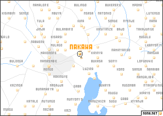
Nakawa (Busoga, Uganda)Nakawa is a town in the Busoga region of Uganda. An overview map of the region around Nakawa is displayed below.
regional and 3d topo map of Nakawa, Uganda ::
Nakawa airports ::
The nearest airport is EBB - Entebbe Intl, located 38.5 km south west of Nakawa.
Other airports nearby include SRT - Soroti (189.5 km north east), Nearby towns ::
Mbuya (0.0km north) //
Kyambogo (1.9km north) //
Kireka (2.4km north east) //
Bugolobi (2.6km south west) //
Kirinya (3.7km east) //
Luzira (4.1km south east) //
Bukoto (4.1km north west) //
Kigowa (4.1km north west) //
Bukasa (4.1km south east) //
Bweyogerere (4.5km north east) //
Buye (5.2km north west) //
Port Bell (5.5km south east) //
Namugongo (5.7km north) //
Kyebando (5.9km west) //
Mulago (5.9km west) //
Bulambiro (6.7km north west) //
Kisaasi (6.7km north west) //
Kira (7.1km north) //
Makindye (7.1km south west) //
Makerere (7.4km west) //
Kira (7.4km north) //
Bwaise (7.6km west) //
Namirembe (7.6km west) //
Buwate (7.6km north) //
Senyi (7.6km east) //
Gaba (7.7km south) //
Kampala (7.8km west) //
Kasiyirize (7.9km north east) //
Mengo (8.3km south west) //
[all distances 'as the bird flies' and approximate]  Places with similar names to Nakawa, Uganda ::
Disclaimer :: Information on this page comes without warranty of any kind |
||
|
Where is Nakawa? Elevation and coordinates ::
Latitude (lat): 0°20'0"S Longitude (lon): 32°38'0"E
Elevation (approx.): 1168m (map arrows pan, magnifying glasses zoom) |
||
|
Visiting Nakawa? Hotel/Accommodation ::
Book a hotel in Nakawa Travel Guide ::
Buy a travel guide for Uganda rental cars ::
car rental offers GPS waypoint ::
download a GPX waypoint (PoI) of Nakawa for your GPS receiver
|
||