|
search place name
|
||
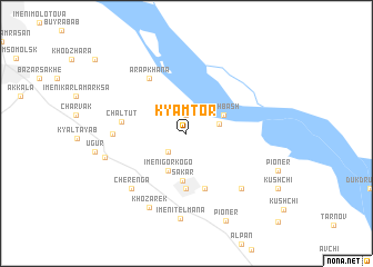
Kyamtor (Turkmenistan)Kyamtor is a town in Turkmenistan. An overview map of the region around Kyamtor is displayed below.
regional and 3d topo map of Kyamtor, Turkmenistan ::
Kyamtor airports ::
The nearest airport is BHK - Bukhara, located 109.8 km north east of Kyamtor.
Nearby towns ::
Dzhengelʼ (1.9km north) //
Sheykh (1.9km north) //
Karamakhmud (2.3km south west) //
Kulayanchi (2.7km east) //
Uch-Bash (3.4km north east) //
Imeni Gorʼkogo (4.0km south) //
Säkar (4.8km south) //
Siyadak-Sakar (5.6km south) //
Dag-Sakhkary (5.7km south) //
Chaltut (5.2km west) //
Arapkhana (6.3km north west) //
Kararyk (5.8km west) //
Cherenga (7.0km south west) //
Imeni Kalinina (7.0km south east) //
Imeni Stalina (8.0km south) //
Khozarek (8.0km south) //
Charvadar (6.8km west) //
Imeni Telʼmana (8.6km south) //
Pioner (9.2km south) //
[all distances 'as the bird flies' and approximate] 
Disclaimer :: Information on this page comes without warranty of any kind |
||
|
Where is Kyamtor? Elevation and coordinates ::
Latitude (lat): 38°58'0"N Longitude (lon): 63°45'0"E
Elevation (approx.): 196m (map arrows pan, magnifying glasses zoom) |
||
|
Visiting Kyamtor? Hotel/Accommodation ::
Book a hotel in Kyamtor Travel Guide ::
rental cars ::
car rental offers GPS waypoint ::
download a GPX waypoint (PoI) of Kyamtor for your GPS receiver
|
||