|
search place name
|
||
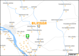
Bilifouda (Niamey, Niger)Bilifouda is a town in the Niamey region of Niger. An overview map of the region around Bilifouda is displayed below.
regional and 3d topo map of Bilifouda, Niger ::
Bilifouda airports ::
The nearest airport is NIM - Niamey Diori Hamani, located 6.6 km south west of Bilifouda.
Nearby towns ::
Garbel (1.9km south) //
Dékala (2.6km north west) //
Gonzaré (2.9km south) //
Ko Gorou (3.4km north east) //
Sagagorou (3.6km west) //
Kabountafa (4.1km south west) //
Gonzaré (6.2km south) //
Ouiman Tama (7.4km south) //
Saga-Aviation (7.4km south west) //
Gondokéré (8.1km south west) //
Tiouré Fandou (8.5km south west) //
Barkiawal Béri (8.8km east) //
Talladjé (8.9km west) //
Gorou Keyna (9.1km north west) //
Serkiré Peul (9.2km south west) //
Tafa Kouara (9.7km south west) //
Guinguindé (10.3km south west) //
Serkiré Zarma (10.6km south west) //
Goungou (11.8km south west) //
[all distances 'as the bird flies' and approximate] 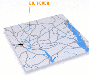 Places with similar names to Bilifouda, Niger ::
Disclaimer :: Information on this page comes without warranty of any kind |
||
|
Where is Bilifouda? Elevation and coordinates ::
Latitude (lat): 13°31'0"N Longitude (lon): 2°14'0"E
Elevation (approx.): 205m (map arrows pan, magnifying glasses zoom) |
||
|
Visiting Bilifouda? Hotel/Accommodation ::
Book a hotel in Bilifouda Travel Guide ::
Buy a travel guide for Niger rental cars ::
car rental offers GPS waypoint ::
download a GPX waypoint (PoI) of Bilifouda for your GPS receiver
|
||