|
search place name
|
||
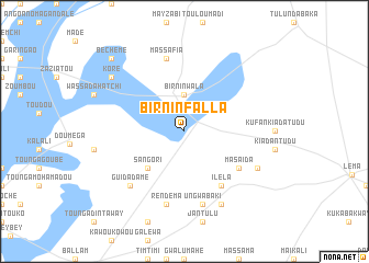
Birnin Falla (Dosso, Niger)Birnin Falla is a town in the Dosso region of Niger. An overview map of the region around Birnin Falla is displayed below.
regional and 3d topo map of Birnin Falla, Niger ::
Birnin Falla airports ::
The nearest airport is SKO - Sokoto Sadiq Abubakar Iii Intl, located 122.2 km east of Birnin Falla.
Other airports nearby include NIM - Niamey Diori Hamani (213.1 km west), THZ - Tahoua (245.3 km north east), Nearby towns ::
Birni Nwala (3.7km north) //
Sangori (5.2km south west) //
Kuham Gaika (6.6km south east) //
Masaida (6.6km south east) //
Ilela (6.6km south east) //
Rendema (7.6km south) //
Ungwa Baki (7.6km south) //
Massafia (7.6km north) //
Guidadamé (7.8km south west) //
Hudussu (8.2km south east) //
Kukoki (8.1km south east) //
Jayi (8.1km south east) //
Koré (9.1km north west) //
Béchémé (10.4km north west) //
[all distances 'as the bird flies' and approximate] 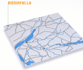 Places with similar names to Birnin Falla, Niger ::
// Brannonville (US)
// Bernienville (FR)
// Bournainville (FR)
// Barnonville (FR)
// Bournonville (FR)
// Bournonville (FR)
// Burnenville (BE)
Disclaimer :: Information on this page comes without warranty of any kind |
||
|
Where is Birnin Falla? Elevation and coordinates ::
Latitude (lat): 12°59'0"N Longitude (lon): 4°5'0"E
Elevation (approx.): 247m (map arrows pan, magnifying glasses zoom) |
||
|
Visiting Birnin Falla? Hotel/Accommodation ::
Book a hotel in Birnin Falla Travel Guide ::
Buy a travel guide for Niger rental cars ::
car rental offers GPS waypoint ::
download a GPX waypoint (PoI) of Birnin Falla for your GPS receiver
|
||