|
search place name
|
||
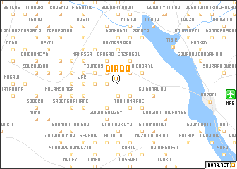
Diado (Maradi, Niger)Diado is a town in the Maradi region of Niger. An overview map of the region around Diado is displayed below.
regional and 3d topo map of Diado, Niger ::
Diado airports ::
The nearest airport is MFG - Maradi, located 17.4 km east of Diado.
Other airports nearby include QUS - Gusau (151.7 km south), SKO - Sokoto Sadiq Abubakar Iii Intl (201.9 km west), KAN - Kano Mallam Aminu Intl (234.6 km south east), THZ - Tahoua (237.3 km north west), Nearby towns ::
Magaji Talé (1.9km south) //
Oubandiawaki (1.8km west) //
Ajia Mijiniawa (2.6km north east) //
Sèrkin Rafi (2.6km south east) //
Magaji (2.6km north west) //
Guigamawa Sofoa (3.6km west) //
Gamou Gayli (4.1km north east) //
Enzangou (4.1km north east) //
Baraya (4.1km north west) //
Dan Gao (4.1km north west) //
Tabkin Marké (4.1km south east) //
Tounous (4.1km north west) //
Guidan Babao (4.1km south west) //
Batilès (5.2km south east) //
Jari (5.4km west) //
May Nassara (5.6km north) //
Oumarou Dakili (5.7km west) //
Garin Mazadou (5.7km east) //
Guidan Alou (5.7km east) //
Dan Adwa (5.7km west) //
Guidan Bouzey (5.8km south) //
Makassa (6.6km north west) //
Mayaoukou (6.6km south west) //
Djin Guilma (6.6km north west) //
Dan Kadou (7.4km north) //
Dan Gwari (7.2km west) //
Garin Mokoyo (7.4km south) //
Guidan Dialo (7.6km north) //
Dan Dabaza (7.4km west) //
[all distances 'as the bird flies' and approximate]  Places with similar names to Diado, Niger ::
Disclaimer :: Information on this page comes without warranty of any kind |
||
|
Where is Diado? Elevation and coordinates ::
Latitude (lat): 13°31'0"N Longitude (lon): 6°58'0"E
Elevation (approx.): 359m (map arrows pan, magnifying glasses zoom) |
||
|
Visiting Diado? Hotel/Accommodation ::
Book a hotel in Diado Travel Guide ::
Buy a travel guide for Niger rental cars ::
car rental offers GPS waypoint ::
download a GPX waypoint (PoI) of Diado for your GPS receiver
|
||