|
search place name
|
||
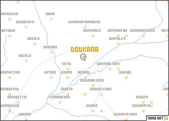
Doukana (Maradi, Niger)Doukana is a town in the Maradi region of Niger. An overview map of the region around Doukana is displayed below.
regional and 3d topo map of Doukana, Niger ::
Doukana airports ::
The nearest airport is MFG - Maradi, located 79.9 km south east of Doukana.
Other airports nearby include THZ - Tahoua (172.0 km north west), SKO - Sokoto Sadiq Abubakar Iii Intl (182.4 km south west), QUS - Gusau (195.7 km south), KAN - Kano Mallam Aminu Intl (300.3 km south east), Nearby towns ::
Bendou (3.7km south) //
Seydi (4.0km south west) //
Inouna (5.2km south west) //
Garin Malamey (5.7km east) //
Guidan Bourka (5.8km south) //
Garin Kado (5.8km north) //
Guidan Assouman (7.4km south) //
Guidan Mohammadou (7.4km north) //
Dan Faro (7.4km west) //
Dumboulogo (7.4km east) //
Kataré (8.1km south west) //
Eskéta (8.2km south west) //
Guidan Labou (8.2km south east) //
Dan Falké (8.1km north east) //
Garin Garba (9.1km north east) //
[all distances 'as the bird flies' and approximate] 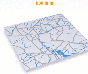 Places with similar names to Doukana, Niger ::
Disclaimer :: Information on this page comes without warranty of any kind |
||
|
Where is Doukana? Elevation and coordinates ::
Latitude (lat): 13°56'0"N Longitude (lon): 6°32'0"E
Elevation (approx.): 320m (map arrows pan, magnifying glasses zoom) |
||
|
Visiting Doukana? Hotel/Accommodation ::
Book a hotel in Doukana Travel Guide ::
Buy a travel guide for Niger rental cars ::
car rental offers GPS waypoint ::
download a GPX waypoint (PoI) of Doukana for your GPS receiver
|
||