|
search place name
|
||
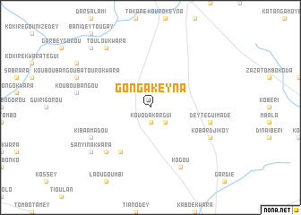
Gonga Keyna (Dosso, Niger)Gonga Keyna is a town in the Dosso region of Niger. An overview map of the region around Gonga Keyna is displayed below.
regional and 3d topo map of Gonga Keyna, Niger ::
Gonga Keyna airports ::
The nearest airport is NIM - Niamey Diori Hamani, located 145.7 km west of Gonga Keyna.
Other airports nearby include SKO - Sokoto Sadiq Abubakar Iii Intl (201.1 km south east), THZ - Tahoua (231.3 km north east), Nearby towns ::
Kouoda Kargui (1.9km south) //
Kofiti (2.6km south east) //
Kiba Tombo (6.6km south west) //
Dey Tégui Madé (7.4km east) //
Daka Lanké (7.8km south west) //
Kobardjikoy (8.1km south east) //
Kogou (8.2km south east) //
Kiba Amadou (8.1km south west) //
Toulou Kwara (9.2km north west) //
Sanyina Kwara (9.1km south west) //
Garsiko (10.3km north west) //
[all distances 'as the bird flies' and approximate] 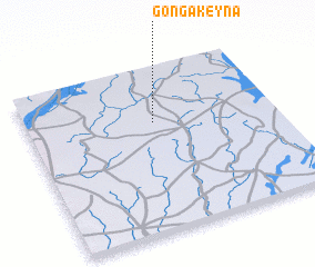 Places with similar names to Gonga Keyna, Niger ::
// Cangugon (PH)
// KuNgqane (ZA)
// Kankaguen (BF)
// Kone Kogne (SN)
// Kangagani (TZ)
// Koniakokoun (GN)
// Kung-kuan (TW)
// Kung-kuan (TW)
// Kung-kuan (TW)
// Kung-kuan (TW)
Disclaimer :: Information on this page comes without warranty of any kind |
||
|
Where is Gonga Keyna? Elevation and coordinates ::
Latitude (lat): 13°40'0"N Longitude (lon): 3°31'0"E
Elevation (approx.): 260m (map arrows pan, magnifying glasses zoom) |
||
|
Visiting Gonga Keyna? Hotel/Accommodation ::
Book a hotel in Gonga Keyna Travel Guide ::
Buy a travel guide for Niger rental cars ::
car rental offers GPS waypoint ::
download a GPX waypoint (PoI) of Gonga Keyna for your GPS receiver
|
||