|
search place name
|
||
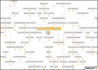
Guidan Abdou (Maradi, Niger)Guidan Abdou is a town in the Maradi region of Niger. An overview map of the region around Guidan Abdou is displayed below.
regional and 3d topo map of Guidan Abdou, Niger ::
Guidan Abdou airports ::
The nearest airport is MFG - Maradi, located 118.4 km south of Guidan Abdou.
Other airports nearby include ZND - Zinder (195.9 km south east), Nearby towns ::
Dan Karami (1.9km south) //
Guidan Mayara (2.6km north east) //
Guidan Tanko (4.1km north east) //
Guidan Ango Labo (4.0km north west) //
Kweyni (4.0km south west) //
Guidan Labo Baré (4.0km south east) //
Guidan Kané (5.2km south east) //
Amanawa (5.6km south) //
Guidan Éko (5.4km east) //
Dan Maza (5.8km north) //
Guidan Malam (5.7km east) //
Guidan Mahama (6.6km north east) //
Dan Ijo (6.5km north east) //
Guidan Ali (6.5km south east) //
Makyérawa (7.4km north) //
Guidan Kané Dan Madougou (7.2km west) //
Baja (7.4km south) //
Makyéra (7.4km west) //
Dobo (8.2km north west) //
Dan Méwassa (10.3km north west) //
Rikiskama (10.3km south west) //
Maylawa (10.3km south east) //
[all distances 'as the bird flies' and approximate]  Places with similar names to Guidan Abdou, Niger ::
// Guidan Abdou (NE)
// Guidan Abdou (NE)
// Guidan Abdou (NE)
// Guidan Bado (NE)
// Guidan Botié (NE)
// Guidan Bouda (NE)
// Kūtānābād (IR)
// Qaţnābād (IR)
// Koutanbado (TG)
Disclaimer :: Information on this page comes without warranty of any kind |
||
|
Where is Guidan Abdou? Elevation and coordinates ::
Latitude (lat): 14°33'0"N Longitude (lon): 7°21'0"E
Elevation (approx.): 435m (map arrows pan, magnifying glasses zoom) |
||
|
Visiting Guidan Abdou? Hotel/Accommodation ::
Book a hotel in Guidan Abdou Travel Guide ::
Buy a travel guide for Niger rental cars ::
car rental offers GPS waypoint ::
download a GPX waypoint (PoI) of Guidan Abdou for your GPS receiver
|
||